Help protect Africa’s  

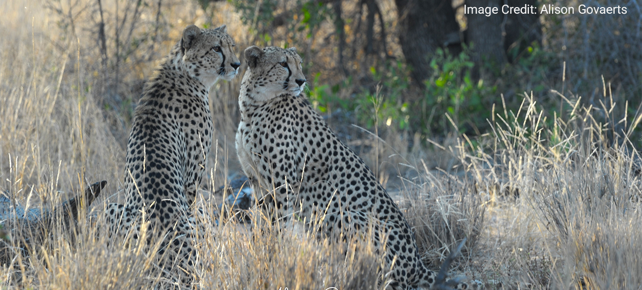
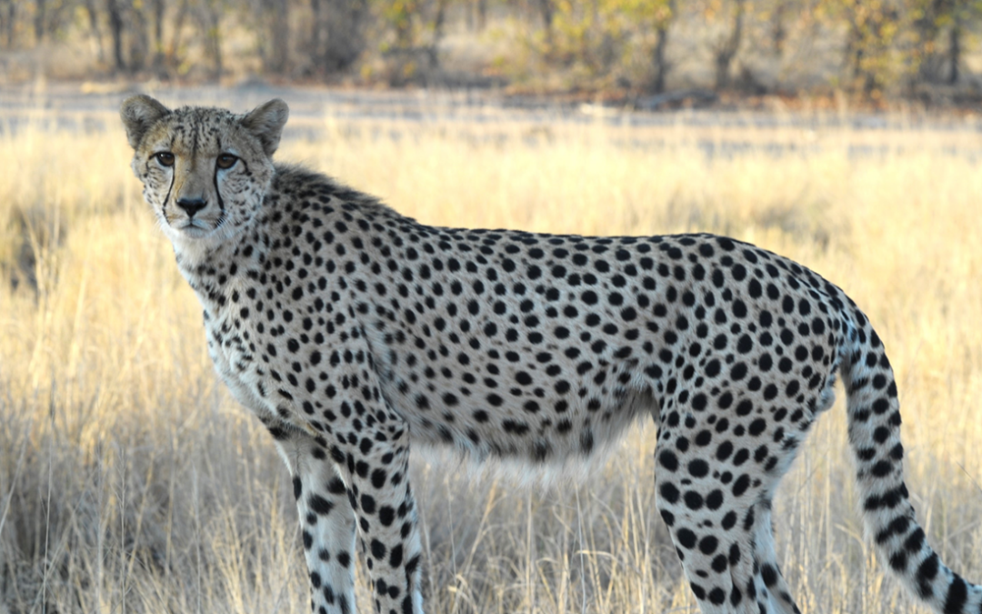
Cheetah photographed during the Greater Kruger Cheetah Census 2026/27.

Cheetah photographed during the Greater Kruger Cheetah Census 2026/27.

Every Spot Counts: The Greater Kruger Cheetah Census 2026/27

By Olivia Sievert, manager of the EWT’s Cheetah Conservation Project
 

Wild cheetah in Greater Kruger identified through its unique coat pattern.

Everyone loves seeing a Cheetah in the wild, but did you know that behind every sighting lies an important scientific opportunity? A simple photograph can help us identify an individual, track its movements, and, when combined with thousands of other records, build a picture of an entire population.

This is the idea behind the Greater Kruger Cheetah Photographic Census, a collaborative initiative between the Endangered Wildlife Trust and SANParks, to improve our understanding of Cheetahs across the Greater Kruger landscape.

Building on decades of photographic monitoring

Photographic censuses of large carnivores have a long history in the Kruger. Citizen-science photographic surveys for African Wild Dogs began in 1988/89, with Cheetahs being first included in 1990. Further Cheetah censuses followed in 2004/05 and 2009/10, before the most recent, in 2021–2022.

The principle is simple: Cheetahs have individually distinctive coat patterns, allowing researchers to recognise the same animal from photographs taken at different times and places. Tourists, guides, staff, and other members of the public can therefore become part of the monitoring effort simply by submitting photographs of the cheetahs they encounter.

The last census in 2021–2022 received 196 Cheetah submissions, of which 151 were suitable for individual identification. From these photographs researchers were able to identify 86 individuals, while statistical modelling estimated approximately 116 Cheetahs across the national park.  These numbers, however, also highlight why the next census is so important. This population estimate was the lowest recorded to date, yet this apparent decline cannot simply be interpreted as a decline in the Cheetah population. The 2021–2022 census had fewer submissions, reduced tourism during the COVID-19 pandemic and introduced AI-assisted identification. Meaning a mixture of low reporting and a change in methods likely also contributed to our recorded population decline.

In other words, we have valuable information, but we still have important questions to answer.

Why Greater Kruger matters

The Greater Kruger landscape is one of the most important remaining strongholds for Cheetahs in southern Africa. As part of the wider Greater Limpopo Transfrontier Conservation Area (GLTFCA), which includes the Kruger National Park, the Associated Private Nature Reserves, and adjoining conservation areas in Mozambique and Zimbabwe, it forms part of a vast connected conservation landscape spanning nearly 100,000 km². Large, connected landscapes are essential for maintaining viable wildlife populations as they allow animals to move between suitable habitats and host large enough populations to maintain genetic diversity without intervention.

The GLTFCA represents roughly three percent of the Cheetah’s remaining global range and contains some of the largest protected areas available to the species in southern Africa. Within South Africa, the Greater Kruger landscape is particularly significant, encompassing approximately 47% of the country’s protected Cheetah habitat. Yet the most recent population estimate suggests that it supports only around 17% of South Africa’s remaining wild Cheetah population.

Large, connected protected areas are critical for the long-term conservation of Cheetahs. The species naturally occurs at low densities, requires extensive areas over which to hunt, disperse, establish territories and avoid competing predators. Additionally, Cheetah are vulnerable to increasing human pressures beyond protected areas where we have seen some of the most drastic population declines in the last 15 years. Therefore, ensuring that protected landscapes such as the Greater Kruger continue to support healthy Cheetah populations will require informed and targeted conservation action.

But, effective management depends on reliable information. We need to understand how many Cheetahs occur across the landscape, where they are found, how they move between areas, and which threats may be limiting their population growth. The Greater Kruger Cheetah Census aims to provide this knowledge, creating the foundation for evidence-based conservation and helping to guide management decisions for one of South Africa’s most important wild Cheetah populations.
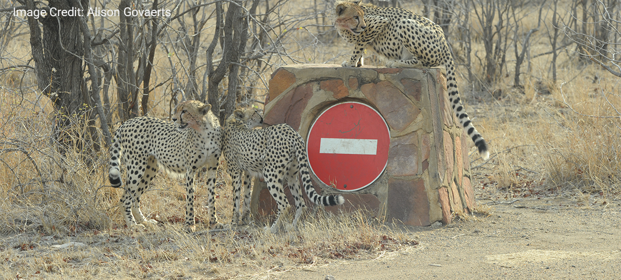
Wild cheetah in Greater Kruger identified through its unique coat pattern.

What do we know, and what don’t we know?

We know that Cheetahs generally occur at low densities, have large ranges and can move considerable distances. During the 2021–2022 census, one individual was recorded as having a potential range of more than 810 km² and moving more than 90 km between sightings.

We also know that photographic monitoring works. But we do not yet have a sufficiently consistent, landscape-scale baseline to answer some of the most fundamental conservation questions confidently. How many Cheetahs are there? Is the population stable, increasing or declining? How many cubs are surviving? How long do individuals live? Are Cheetahs making use of the wider landscape? And what threats are impacting the population? All these questions are imperative to answer if we want to properly conserve the Cheetah across the Greater Kruger.

Turning photographs into conservation action

The 2026/27 census aims to build on this history by bringing together new photographic submissions with historical photographs, camera-trap images, ranger records, existing monitoring data, and other available information. Individual Cheetahs will be identified using AI-assisted coat-pattern recognition, with manual verification where necessary.

The goal is not simply to produce another population estimate. We want to establish a reliable baseline for the Greater Kruger Cheetah population, understand how individuals move and survive across the landscape, identify important core population areas and potential connectivity routes, and improve our understanding of threats. This information can ultimately support more targeted threat reduction, better coordination between conservation areas, and adaptive management.

You can help

If you are visiting Greater Kruger landscape between 1 September  2026 and 31 August 2027, you can take part in the census.

If you see a Cheetah, take photographs from a safe and respectful distance. Where possible, photographs of both the left and right sides of the animal are especially valuable because they help us distinguish individuals accurately.

When submitting your sighting, please include:

  • The photographs of the Cheetah(s);
  • The date of the sighting;
  • The approximate location, GPS coordinates, road number, or nearest landmark;
  • The number of Cheetahs observed; and
  • Any additional observation.

Every photograph adds another piece to the puzzle. A single image may help identify an individual; repeated sightings can reveal movements and survival; and thousands of photographs collected over time can help us understand the population as a whole.

Your next cheetah sighting could help shape the future of Cheetah conservation in Greater Kruger:  Every Spot Counts.

Cheetah photographed during the Greater Kruger Cheetah Census 2026/27.

** This work is being done in partnership with SANParks. Funding is provided by DERTOUR Foundation and SANParks Honorary Rangers Fund with support from Ford Wildlife Foundation, SANParks Honorary Rangers and Tech4Conservation.
EWT team returns to Kgalagadi Transfrontier Park to conduction lion research

EWT team returns to Kgalagadi Transfrontier Park to conduction lion research

EWT team returns to Kgalagadi Transfrontier Park to conduct lion research


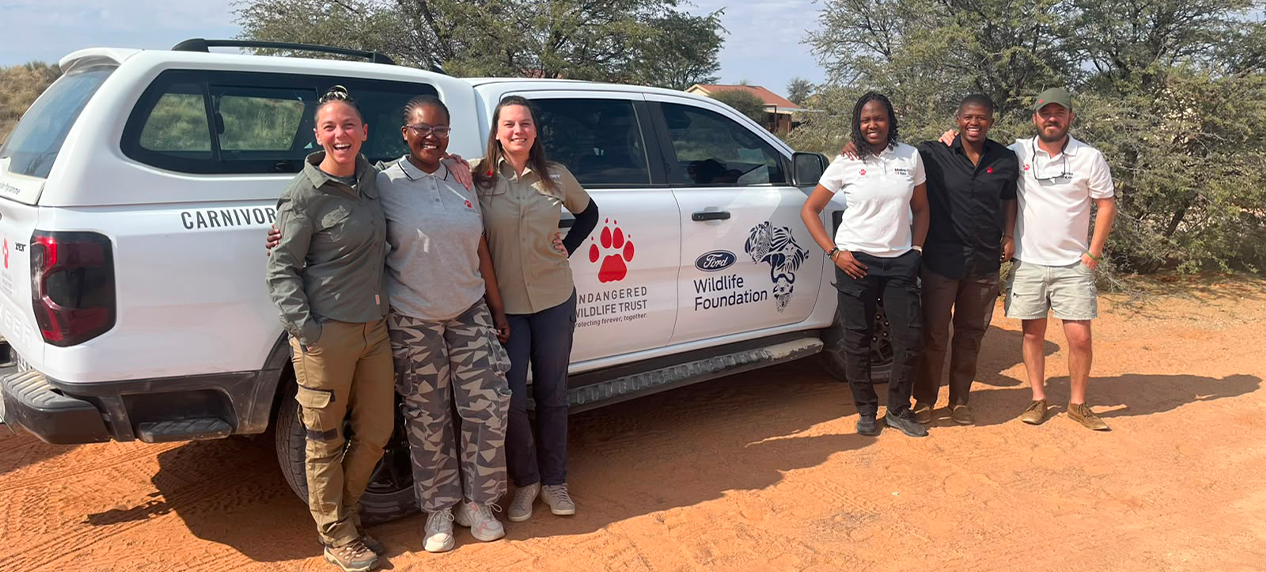
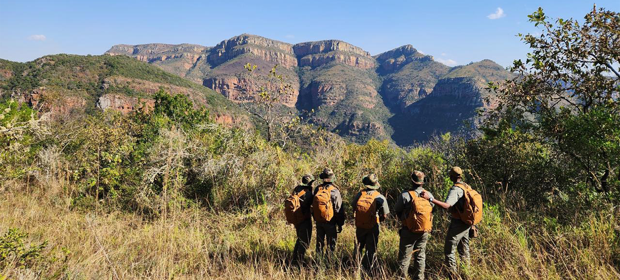
EWT researchers conducting the Kgalagadi lion population census in South Africa.

An Endangered Wildlife Trust team has returned to the Kgalagadi Transfrontier Park to conduct this year’s lion population census, helping SANParks monitor and better understand the lion population in the park.

The lion monitoring project started on 1 August and ends on 31 October 2026.  In 2025, the team had also spent three months in the Kgalagadi Transfrontier Park, which spans South Africa and Botswana, to collected the first tranche of data about the lions living in this desert landscape.

In the next three months, the EWT team, supported by SANParks, will determine how many lions are estimated to live in the South African part of the Transfrontier Conservation Area, their demographics, and their spatial distribution within the park.  A team from Kalahari Research and Conservation are undertaking a similar project on the Botswana side of the Transfrontier Conservation Area.

Repeated annual surveys will form the base for subsequent, less frequent long-term monitoring of the Kgalagadi lion population – the second-largest free-roaming lion population in South Africa.

Understanding the status and performance of this population is central to national lion conservation planning and to the long-term management of the broader transboundary ecosystem.  It supports SANParks in the effective management of lion populations within its parks.

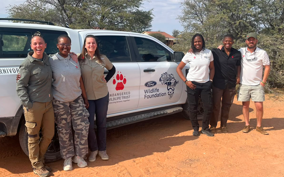
The core team comprises four women and two men.  It is led by the EWT Carnivore Conservation Unit’s data analyst, Alison Govaerts, who is supported by EWT project manager Marnus Roodbol.  Also on the team are EWT field technicians Nonkuleleko Mokobong, Lesedi Leope, Sabelo Mahlangu and Lizaene Cornwell.

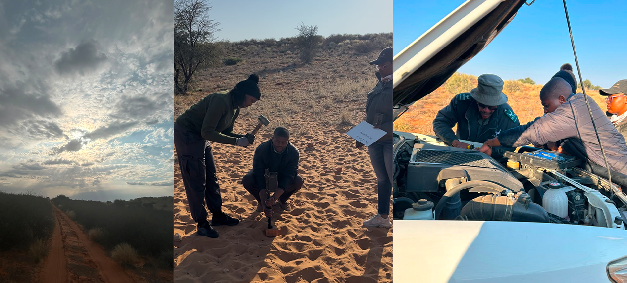
Field researchers monitoring lions across the Kgalagadi Transfrontier Park.

The team are using photographs and camera trap footage to individually identify each encountered lion (excluding lion under one-year-old) using their unique whisker pattern.

At the end of the three-month period, the results and reports of the surveys by the EWT and Kalahari Research and Conservation will be combined to estimate lion numbers across the whole Transfrontier Park. As the lions move freely across borders, some individuals will be identified by both teams. By combining the survey data, possible double counting of these lions will be avoided.

Through the monitoring of existing populations, we are able to keep track of population dynamics, which provides a powerful tool to inform management strategies and to identify potential threats in time.  The protection and conservation of lions remains a priority for this apex predator that plays a central role in keeping the balance within ecosystems by maintaining a healthy prey base, and keeping the meso-predator population in check. Without lions, prey populations would risk overgrazing the landscape.

Lions are a flagship species, and are a popular sighting as a key member of the Big Five during safaris. Thus, their economic importance.

Lion are also culturally important as they symbolise power, strength, and leadership, and are embedded in many practices, ranging from representing totems and clans, to being a symbol or name for sports teams, or play a role in spiritual and traditional customs.

In partnership with SANParks, and with the support of the Lion Recovery Fund and private donors, the EWT is taking a important step forward for lion conservation.

EWT Carnivore Conservation Unit carrying out lion population surveys.

Visiting Mozambique’s youngest national park

Visiting Mozambique’s youngest national park

Visiting Mozambique’s youngest national park

By Darren Pietersen, EWT Threatened and Endemic Species project management


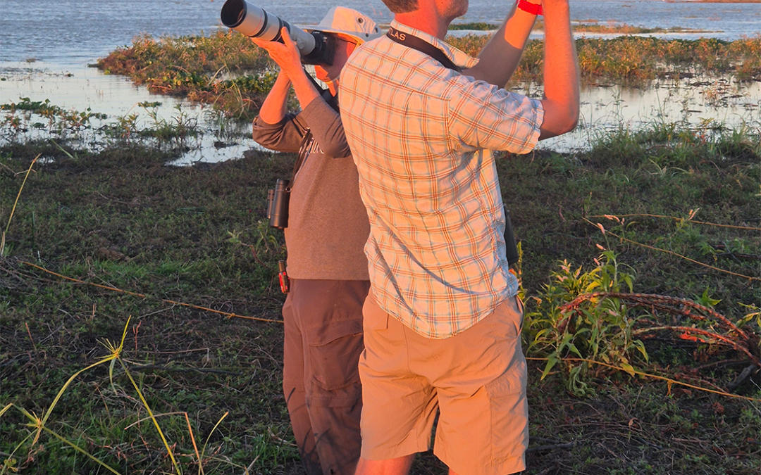
EWT researchers conducting wildlife surveys in Mágoè National Park's Zambezi Valley bushveld.

From mid-June to late-July 2026, the Endangered Wildlife Trust’s Carnivore Conservation Unit, together with representatives from Catawba University in the United States, paid a three-week visit to Mágoè National Park in Mozambique. The primary goal  was to determine whether large predators (particularly African lions) persisted in the landscape, although the opportunity was taken to conduct a general, rapid biodiversity survey at the same time.

After three days of travel by road, I met the rest of the team at Tete International Airport, and after the usual delays at customs, the team set out for Mágoè National Park (250 km and seven police roadblocks later).

Mágoè is Mozambique’s youngest national park and is nestled on the southern banks of Lake Cahora Bassa, between the Zimbabwean border and the town of Songo where the Cahora Bassa Hydro-electric power station is located.  Named after the nearby town, Mágoè National Park was established in 2013 and encompasses approximately 3 559 km2 of largely unspoilt Zambezi Valley bushveld.

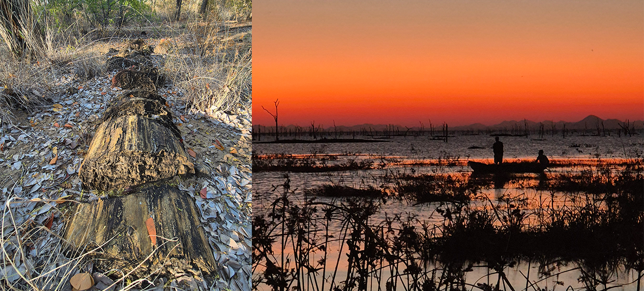
Lake Cahora Bassa shoreline in Mágoè National Park during a three-year drought.

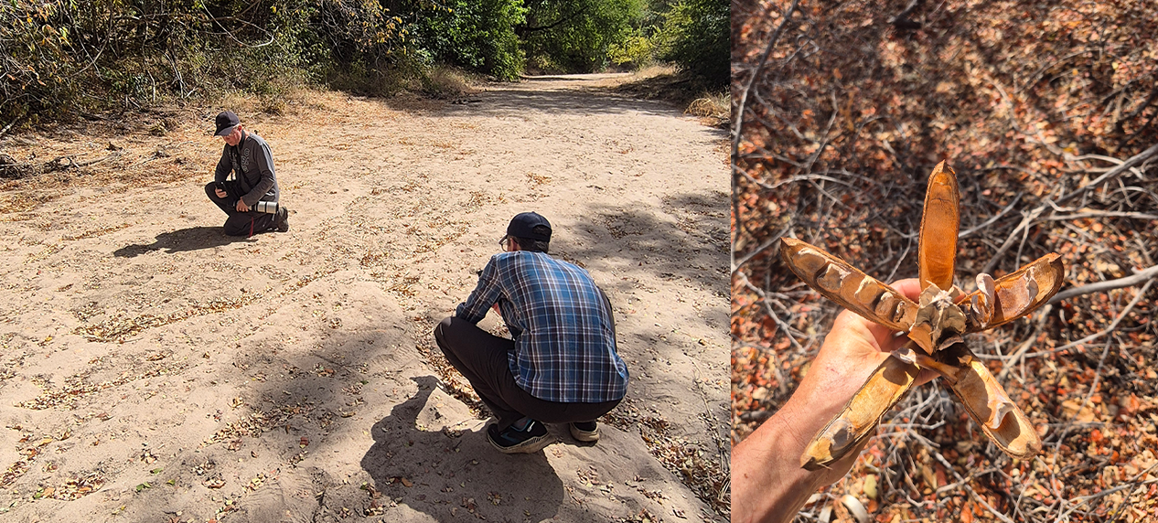
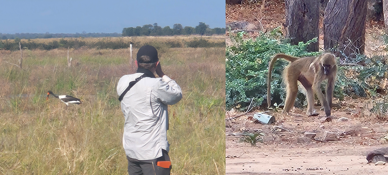
Right: Caprivi Wooden-Banana Entandrophragma caudatum

Prior to being declared a national park, this was previously the Tshuma Tchato community conservation area which was  mostly leased as hunting concessions to Mozambican or foreign safari companies.

As is typical of most of the Zambezi Valley, Mágoè National Park is dominated by tall Mopane woodland, with a few low rocky ridges. One outstanding feature of the park is Serra Comboio – a large (roughly 25 x 7 km) sandveld plateau rising about 300 m above the surrounding plains. At the time of our visit the area was in its third consecutive year of drought, and the low lake levels resulted in a wide, short grassy plain extending up to 3 km from the lakeshore treeline to the current lakeshore. The effects of the drought were further manifested in the many fishing villages that had been temporarily abandoned, and a concomitant number of temporary abodes that had been erected much nearer the current shoreline. This national park hosts a significant human population, with most people living along its shored relying on these waters for protein, in the form of the innumerable fish that are harvested each day.

The generally uniform vegetation, which is predominantly dry Mopane Woodland, resulted in a relatively low recorded species diversity, although the prevailing drought and the season (winter) did not aid the general biodiversity survey either despite this being the ideal time to survey large carnivores.

EWT researchers conducting wildlife surveys in Mágoè National Park's Zambezi Valley bushveld.

Right: Grayfoot Chacma Baboon Papio ursinus ssp. griseipes

Nonetheless, we recorded 208 bird species, submitted 18 Full Protocol cards across 16 pentads to the Second Southern Africa Bird Atlas Project (SABAP2), and 14 pentads of which had not been surveyed since the inception of the project in 2006 (so-called virgin pentads). We also submitted incidental bird sightings for an additional 22 virgin pentads. The bird highlights included recording a Lesser Black-backed Gull which is a  rarity in southern Africa, and being awakened each morning by the raucous calls of Grey-necked and Meyers Parrots, as well as Lillian’s Lovebirds. Waterbirds were numerous, with egrets and herons of every shape and size, including the presence of Black Herons with their characteristic ‘umbrella’  hunting technique.

Because of the relatively high human density along the lakeshore, the waterbirds were also generally trusting – certainly a lot more so than is typical. We saw several flocks of Banded Martins – an intra-African migrant to southern Africa in the Austral summer – that should have been on their wintering grounds in Central and East Africa already. The number of martins recorded, and the time of year, could suggest that this species overwinters along Lake Cahora Bassa, or may even be resident here, although much more data needs to be gathered to ascertain the status of this population.

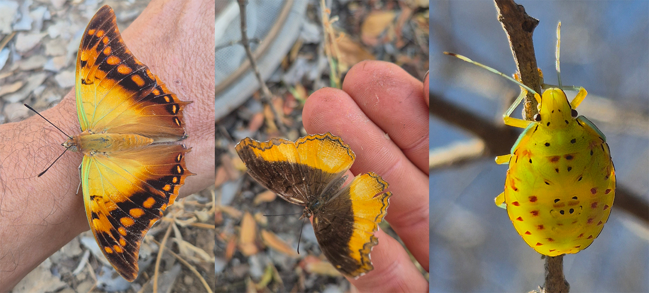
The Mucumbura River Floodplain in the west of the park has a high likelihood of hosting regional rarities and vagrants, especially in summer. Even during our visit, we recorded White-browed Coucal, Dwarf and Little Bittern, Lesser Moorhen and Orange-breasted Waxbills here. Across the park we also recorded 37 mammal species, 33 reptile species, two amphibian species and 51 invertebrate species which included 23 butterfly species, five of which were Charaxes species – not bad for a mid-winter survey!

Mágoè National Park in Mozambique during an EWT biodiversity and carnivore survey.

Left: Green-veined Emperor Charaxes candiope. Centre: Southern Golden Piper Eurytela dryope ssp. angulata. Right: Two-spotted Stinkbug Bathycoelia distincta.

And the carnivores? We did not record any evidence of lions, although that does not mean that they do not occur in the area. The Carnivore Conservation Unit’s Osvaldo Abrão placed 40 trail cameras that were left in-situ for two months, passively recording mammals well after the survey team had left. These cameras will be lifted in early September, and will give the team a better idea of what mammal species really occur in the area. Who knows – perhaps they will reveal one or more images of lions after all.

We did, however, record Spotted Hyena during our trip, as well as leopard, Black-Backed and Side-Striped Jackal, Caracal and numerous civets, genets and other smaller carnivores. We also recorded a lot of African Elephant activity, as well as Cape Buffalo and varying levels of plains game, particularly in the western section of the park.

Being a relatively new national park, Mágoè still has a lot of room to grow, and with the keen management at the helm (and perhaps with a little outside support from a suitable funder and advisor), it will be interesting to see how the park develops further in the coming years.

Left: Petrified log. Right: Sunset over Cahora Bassa.

** This work has been made possible by the Oak Foundation

Uncovering Hidden Biodiversity in Northern Malawi

Uncovering Hidden Biodiversity in Northern Malawi

Uncovering Hidden Biodiversity in Northern Malawi

By Dr Samantha Theron, EWT conservation researcher


Field team conducting eDNA biodiversity surveys in Malawi's Nyika National Park wetlands and rivers.

Deep in the heart of Africa, situated between two major faults of the African Rift Valley – Lake Malawi and the Luangwa Valley – lies the Nyika Plateau.  This is the largest montane complex in south-central Africa.

The plateau, along with its surrounding escarpments and hills, comprises the 3,134 km² Nyika National Park (NNP), a  protected area that is not only a sanctuary for diverse fauna and flora, but which also plays a vital role in safeguarding some of the most significant water catchment areas in northern Malawi. The name “Nyika,” means “where the water comes from,” and reflects its importance as one of Malawi’s key water catchment areas.

Several rivers, including the North Rumphi, Chilinda, Runyina, and North Rukuru, originate on the Nyika Plateau and ultimately flow into Lake Malawi. To the southwest lies the 986 km² Vwaza Marsh Wildlife Reserve. Water from the Hewe River, which originates in Nyika National Park, creates a marsh in the northern part of the reserve. Together with Nyika National Park in Zambia, these protected areas form part of the Malawi-Zambia Transfrontier Conservation Area.

Since a 20-year co-management agreement was signed between Malawi’s Ministry of Tourism and Peace Parks Foundation in 2023, efforts have focused on managing Nyika and Vwaza as a connected landscape. Understanding the biodiversity within these areas is an important part of effective conservation planning. It is in this context that the Endangered Wildlife Trust (EWT) was recently approached to conduct an environmental DNA (eDNA)-based vertebrate biodiversity assessment of Nyika.

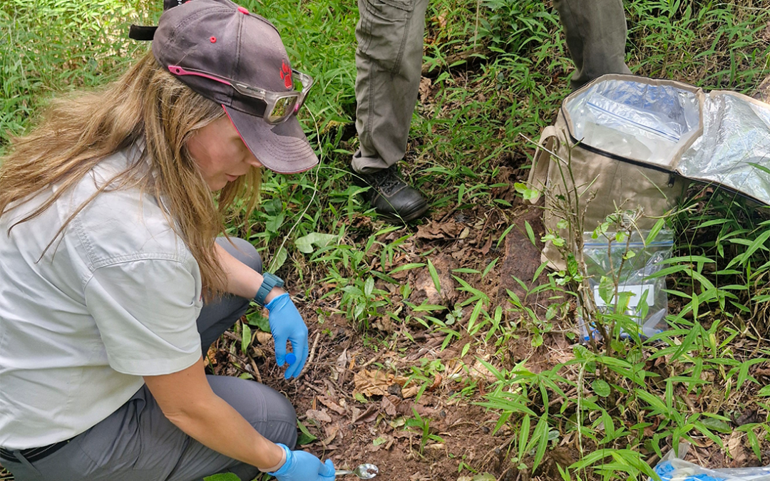
Environmental DNA (eDNA) sampling in Nyika National Park, Malawi, to uncover hidden vertebrate biodiversity.

Finding traces of wildlife through eDNA

Environmental DNA (eDNA) is genetic material that animals leave behind in their surroundings. This includes skin cells, hair, faeces and other biological material.  By analysing environment samples from, for instance, water, soil and sediment, scientists are able to determine which species are present.

However, eDNA also has limitations. Species identification depends heavily on genetic reference databases such as GenBank and BOLD, and many species from remote and under-sampled regions are not yet represented in these databases. As a result, some DNA sequences can only be identified to a broader group, such as a genus or family.

This is particularly important in regions where cryptic species may occur. Animals that appear identical may be genetically different, meaning conventional surveys can underestimate biodiversity.

From the plateau to the laboratory

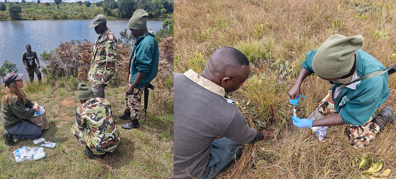
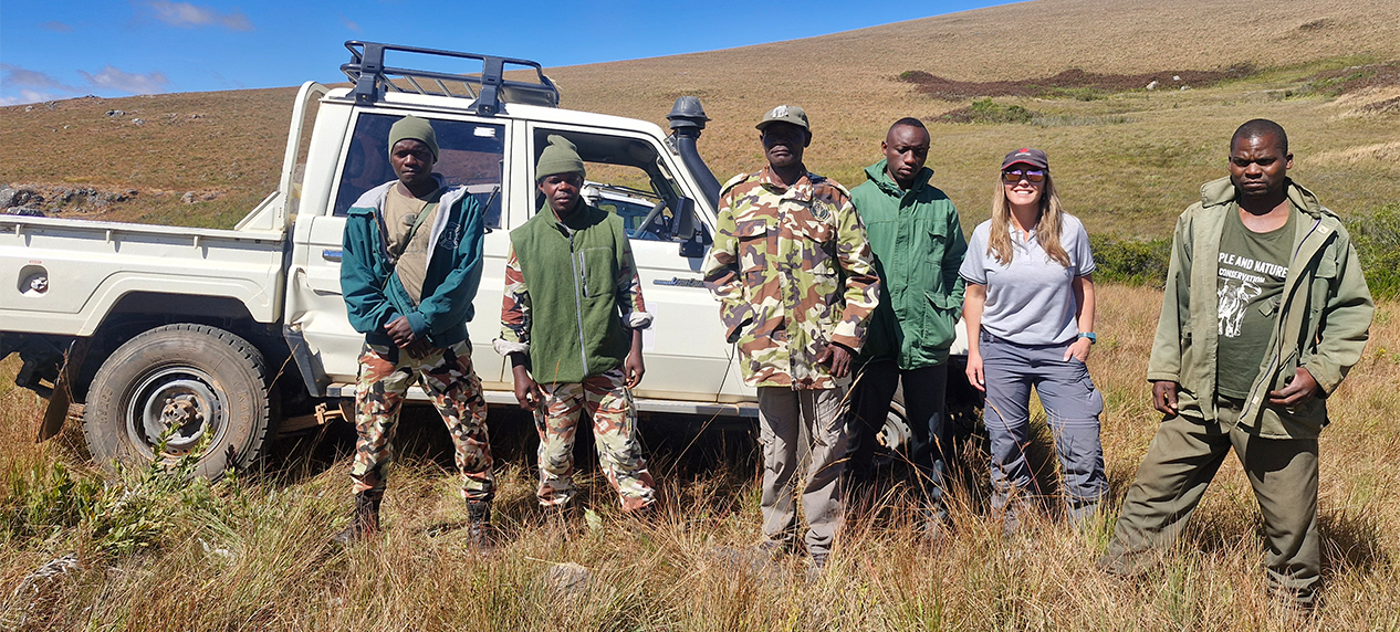
The Nyika assessment involved 10 sampling sites selected to represent ecologically important habitats and key points within the park’s water systems. Fieldwork began with training Nyika staff and rangers in water and soil sampling techniques.

At Lake Kaulime, participants learned how to collect water samples. Soil sampling was subsequently demonstrated in forest patches, where the rangers contributed their own knowledge of animal activity and visible trails to help identify suitable sampling locations.

The trained field team then collected samples from a range of environments, including wetlands, forests, waterfalls and river systems. Some of these locations required challenging hikes through dense vegetation and steep terrain.

The samples have subsequently been transported to the EWT laboratory in Stellenbosch. Here, we will isolate DNA, amplify genetic barcodes, sequence the DNA and compare the barcode sequences with existing reference databases to identify the species represented in the samples.

A baseline for future conservation

The project is intended to provide an initial baseline of vertebrate biodiversity in Nyika while testing the usefulness of eDNA as a biodiversity monitoring tool in the landscape.

The results could identify species that are difficult to detect through conventional surveys and highlight areas or taxonomic groups requiring further investigation. They may also reveal previously unrecognised genetic diversity and potentially point to species that are unknown to the park, or even to science.

Importantly, this first survey is not expected to provide a complete inventory of Nyika’s biodiversity. Seasonal changes in animal activity can influence which species are detected, meaning repeated sampling across different habitats and times of year will be necessary to build a more comprehensive picture.

There is also an urgent need to expand genetic reference databases for species occurring in the region. As new reference barcodes are generated, the accuracy and value of this and future eDNA surveys will increase.

Environmental DNA is no longer a new scientific technique, it is gaining traction globally as an important tool for monitoring biodiversity. For Nyika, it may prove to be highly valuable in establishing the information needed to understand, monitor and ultimately protect one of Malawi’s most important interconnected landscapes, its wildlife, its forests and, ultimately, the valuable water sources that give Nyika its name.

EWT researchers collecting water samples for eDNA biodiversity monitoring on the Nyika Plateau.

** This project is undertaken in collaboration with Peace Parks Foundation (PPF) and funded by the Deutsche Postcode Lotterie (DPL) (German Postcode Lottery).

Impending El Niño: Implications similar for Conservation, Agriculture and Water Security in South Africa

Impending El Niño: Implications similar for Conservation, Agriculture and Water Security in South Africa

Impending El Niño: Implications similar for Conservation, Agriculture and Water Security in South Africa

By Dr Ian Little, head of Conservation


Drought-stressed South African landscape illustrating the conservation impacts of El Niño.

The onset of a very strong El Niño event during the second half of 2026 is expected to hold similar consequences for conservation, agriculture and water security in South Africa.

Climate models are increasingly showing that the conditions arising from El Niño are likely to peak between October and December this year, and persist into early 2027.

The most recent international forecasts indicating one of the highest probabilities yet observed for a strong-to-very-strong El Niño, raise concerns for southern Africa, where El Niño has historically been associated with below-average summer rainfall, elevated temperatures and widespread drought.  Although every El Niño differs, the anticipated event warrants immediate planning by farmers, conservation practitioners, water managers and urban residents.

Historically, El Niño years have produced delayed onset of summer rainfall, reduced rainfall across the summer rainfall region, higher daytime temperatures, increased frequency and duration of heatwaves, lower streamflows, lower dam inflows and greater wildfire danger during late winter and spring.   The strongest impacts are generally experienced across Limpopo, North West, Free State, Mpumalanga, Gauteng and much of the Eastern Cape interior. The Western Cape, which receives predominantly winter rainfall, is usually less directly affected, although high temperatures and increased evaporation may still place pressure on water resources.

Implications for Agriculture

Agriculture is among the sectors most vulnerable to El Niño. Reduced rainfall during planting seasons can substantially decrease maize, sunflower and soybean production, amongst others. Heat stress during flowering and grain filling further reduces yields while increasing irrigation demand.

Livestock farming faces equally significant risks. Many of these important livestock production areas fall within the grassland biome where the Endangered Wildlife Trust (EWT) works extensively to improve habitat management, declare protected areas and restore transformed ecosystems for the protection of threatened species. Poor rainfall results in reduced grass production, declining veld condition and lower carrying capacity. Water points dry earlier, increasing pressure on remaining resources and accelerating land degradation through overgrazing. Livestock experience reduced fertility, lower weight gain, increased disease susceptibility and greater mortality where supplementary feeding is inadequate. Mitigating these impacts should centre on pro-actively reducing stocking rates to increase resilience in line with reduced carrying capacity of the hydrologically stressed system.

Other key proactive actions could include building fodder reserves while feed remains relatively affordable, repairing water infrastructure and improve storage capacity, rotating grazing to protect veld condition, developing contingency drought budgets and marketing plans and working closely with veterinarians to minimise disease risks associated with nutritional stress.

Conservation implications

The conservation sector faces many of the same challenges as agriculture. Protected areas may experience declining water availability, reduced grazing and browsing availability, increased wildlife concentrations around remaining water sources and heightened competition between herbivores. Smaller wetlands may dry completely, affecting amphibians, waterbirds and aquatic biodiversity. Vegetation under drought stress becomes increasingly susceptible to insect outbreaks, invasive species and wildfire.

However, well-managed protected areas often demonstrate greater ecological resilience because intact ecosystems retain soil moisture more effectively, support groundwater recharge and maintain healthier ecological processes than degraded landscapes. The EWT has secured over 200,000 hectares of newly declared protected areas with improved habitat management and is working on a further >250,000 hectares of priority area declarations for the protection of key threatened species habitats and climate resilience.

Grassland catchments: South Africa’s natural water infrastructure

Perhaps the most important long-term climate adaptation strategy is protecting South Africa’s strategic water source areas, particularly the high-altitude grassland catchments that supply much of the country’s surface water. These catchment areas also support a disproportionately high number of South Africa’s threatened and endemic species, making their long-term preservation critical from a conservation perspective. This is a core focal biome for the EWT with key areas in the Amathole Mountains, near Hogsback in the Eastern Cape, the KZN midlands, the escarpment and plateau of the Northern Drakensberg in the eastern Free State and the Steenkampsberg plateau around the town of Dullstroom in Mpumalanga. Although these catchments occupy a relatively small proportion of South Africa’s land area, they generate a disproportionately large share of river flow supplying major urban centres, industries and agricultural regions.

Healthy grasslands perform several critical ecosystem services, including but not limited to increasing rainfall infiltration, recharging groundwater, reducing soil erosion, moderating flood peaks, sustaining dry-season river flows, improving water quality and increasing resilience during drought. Conversely, degraded grasslands lose their sponge-like capacity to absorb rainfall. Water runs rapidly off compacted soils, causing erosion during storms while leaving rivers with reduced baseflows during dry periods.

Restoration through improved grazing management, erosion control, alien plant clearing, ecologically responsible fire management and wetland protection therefore represents one of the most cost-effective climate adaptation investments available to South Africa.

Healthy catchments function as natural infrastructure, complementing built dams and reservoirs while reducing treatment costs and increasing water security.

Preparing urban South Africa

Urban residents are often insulated from seasonal climate variability until water restrictions become necessary. Nevertheless, prolonged drought can rapidly reduce reservoir storage and increase pressure on municipal water supplies.

Households can improve resilience by:

  • Reducing unnecessary water consumption.
  • Repairing leaking taps and toilets.
  • Installing low-flow fittings.
  • Harvesting rainwater where feasible.
  • Reusing greywater for gardens.
  • Planting indigenous drought-tolerant vegetation.
  • Maintaining emergency household water storage.
  • Supporting municipal efforts to reduce non-revenue water losses.

Municipalities should simultaneously accelerate leak detection, infrastructure maintenance, groundwater development where appropriate and public awareness campaigns before severe shortages emerge.

Through the implementation of nature-based solutions, ecosystem restoration, and supporting communities in implementing resilience initiatives, the Restoring South Africa’s Landscapes for Climate (ReLISA) Project is targeting the restoration of 100,000 of vital biomes in areas such as the Northern Drakensberg and by 2030 to enhance water and climate security.  Climate and Carbon Financing initiatives see the EWT partnering with private landowners and rural communities to create viable carbon projects that financially reward sustainable land stewardship and carbon capture, and the Drakensberg Crane Habitat Carbon Project has already seen the successful registration of a 90,000-hectare carbon offsetting project that rewards landowners for sustainable grassland and wetland management, reducing emissions while protecting vulnerable bird species.

Agriculture, biodiversity conservation and water security are closely interconnected, and actions taken during the months preceding drought often determine its ultimate impacts.

Protecting strategic grassland catchments offers perhaps the greatest long-term investment in national climate resilience, especially those catchments that supply our large urban centres Healthy ecosystems support reliable water supplies, sustain biodiversity and buffer communities against increasingly variable climatic conditions. Combined with improved agricultural planning, responsible water use and adaptive management, these natural systems will become increasingly important as climate change amplifies the frequency and severity of extreme weather events.

Rather than responding only after drought develops, South Africa has an opportunity to strengthen resilience before the anticipated impacts of the 2026–2027 El Niño unfold.

Planning for Flight Paths: Bird Monitoring at Energy Infrastructure

Planning for Flight Paths: Bird Monitoring at Energy Infrastructure

Focus on Wildlife in Nature

As Africa’s energy needs increase, and the continent embraces the growth and implementation of green energy, a number of innovative methods have had to be developed to reduce the negative interactions between wildlife and infrastructure.

The Endangered Wildlife Trust’s Wildlife and Infrastructure (WIN) Unit, has developed numerous innovative methods to reduce these interactions, work to positively influence utilities’ wildlife management policies, and ultimately phase out problematic processes and hardware. Through adaptive management and the development of pioneering and innovative techniques, South Africa is now recognised as a world leader in managing the burden of wildlife damage on electrical infrastructure while addressing the threats to wildlife.

In the final article of the three-part series, the WIN team discusses the monitoring of bird species before and after the construction of energy facilities.

Planning for Flight Paths: Bird Monitoring at Energy Infrastructure

By Hennie de Beer, Tamanna Patel, Matt Pretorius, Oscar Mohale, Kish Chetty


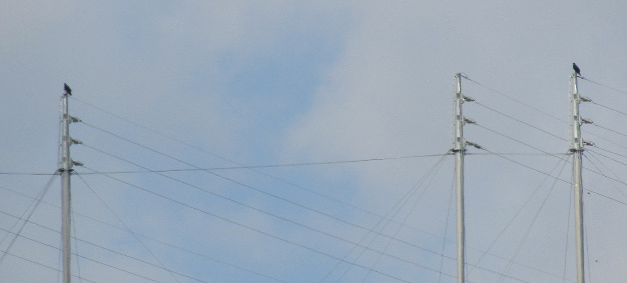
Bird monitoring along power lines to reduce collision and electrocution risks in South Africa.

South Africa’s Wind Energy Facilities (WEF) track bird activities closely, before and after construction. Power lines get no such attention once they run beyond a facility’s own footprint. This article explains why that gap persists and what it would take to close it.

The line that goes unwatched

Wind energy has benefited from a decade of increasingly refined monitoring protocols. Power lines have not. Guidance does exist, including the World Bank’s overhead-line survey methods, but it was designed mainly for lines associated with a WEF, not for the thousands of kilometres of transmission and distribution corridors that cross the country independently. For overhead lines outside a WEF, the guidance itself acknowledges that there is no standard method; monitoring is left to case-by-case judgement based on line length, risk and available resources.

Northern Cape wind farms uncovered electrocution risk on their own above-ground collector lines because those lines sat within a monitored WEF footprint. Beyond that footprint, two forms of monitoring exist, but neither systematically catches bird fatalities. Eskom carries out annual/biannual line inspections, carried out by technical staff as part of routine hardware checks, regularly pick up wildlife mortalities, and flag structures that pose a collision or electrocution risk, feeding into the Eskom and Endangered Wildlife Trust Strategic Partnership’s hotspot identification and structure reconfiguration work.

Certain recent lines have monitoring built into their Environmental Management Programme (EMPr), where the Environmental Impact Assessment (EIA) process identified them as crossing sensitive areas under the National Screening Tool and DFFE Powerlines Strategic Environmental Assessments (SEAs). The opportunity is to build on that foundation, not to start from nothing. Folding a short wildlife checklist into the hardware inspections technical staff already carry out, rather than treating bird monitoring as a separate exercise, could extend coverage across the network at a fraction of the cost of a standalone programme. The same logic applies to lines built before the National Screening Tool existed: routine inspections could flag them for a one-off risk review rather than requiring a wholesale audit of the older network.

Species we still do not understand well enough

Some species remain difficult to protect because the available data is still limited. The Black Harrier (Circus maurus) is an exception. Near-endemic to southern Africa and listed as Endangered, it is one of the better-studied cases: its regional population is estimated at only 733 to 938 mature individuals and is declining by about 2.3% each year. Population viability modelling suggests that the species has a greater than 50% chance of extinction within 75 to 100 years if fatalities increase by only three to five adult birds per year above baseline mortality.

BirdLife South Africa’s 2025 Red Data Book assessment records at least 13 confirmed adult Black Harrier fatalities across South Africa’s 33 operational WEFs since 2014. Once under-detection is considered, the true number could be closer to double, leaving little margin before the population reaches the fatality threshold identified by modelling.

Bustards present a different kind of knowledge gap. Ludwig’s Bustard (Neotis ludwigii), which is Endangered and nomadic, and Denham’s Bustard (Neotis denhami), listed as Vulnerable, appear in national fatality records at turbines and along power lines. At turbines, Ludwig’s Bustard and Denham’s Bustard, the recorded numbers are still single digits, too few to reveal which routes, seasons or conditions carry the highest risk. The picture for power line fatalities is less settled: current published data understates the true toll, with more recent findings not yet in print suggesting the numbers are higher.

Verreaux’s Eagle (Aquila verreauxii) and Martial Eagle (Polemaetus bellicosus) face a related problem at a larger scale. Both are killed by turbine collision and by electrocution on power lines, but no single dataset currently combines turbine and power-line records to show the total pressure on either population.

Where the turbine solution runs out

Bird Flight Diverter (BFD) design must match a species’ activity pattern, and proving that a diverter works requires a genuine Before-After-Control-Impact (BACI) study, rather than simply observing a decline in fatalities. For turbines, the practical approach is deliberate zoning: selecting turbines with comparable pre-treatment collision rates, then leaving some unmarked controls while fitting the rest with diverters. Zoning by risk level and treating only the high-risk turbines would bias the comparison from the outset, since the control and treatment groups need equivalent baseline exposure for the before-after comparison to hold.

It is tempting to assume that the same model can be carried over to power lines. It cannot, at least not cleanly. BACI’s statistical strength depends on collision rates being comparable between control and treatment groups before mitigation begins. At a single WEF, turbines usually share broadly similar terrain, spacing and species exposure, making it relatively straightforward to identify suitable controls.

Power lines are different. A line can change character within only a few kilometres as span height, surrounding habitat and bird movement patterns shift from one section to the next. Treating an unmarked span as a control without first confirming that its pre-mitigation collision rate resembles that of the marked span is not a genuine comparison. A BACI study based on that assumption may look rigorous while producing unreliable conclusions.

The answer is not to delay mitigation until a perfect study becomes possible. Developers often have to prioritise immediate risk reduction over years of pre-marking baseline data collection because installation costs and project timelines do not disappear. The more practical solution is to design comparability into BFD rollouts from the outset, so that marking a line and evaluating whether the marking works are not treated as competing objectives.

Turning gaps into a plan

None of this erases what the first two articles in this series documented: pre-construction surveys can shape turbine layouts, post-construction monitoring can identify what those surveys missed, and adaptive management can measurably reduce fatalities. It does mean that the next phase of work has a clear focus:

  • Develop standardised guidelines for power-line monitoring, built for linear corridors rather than adapted point-based turbine protocols.
  • Extend post-construction monitoring requirements further along transmission and distribution networks, instead of stopping at WEF boundaries.
  • Build secondary ecological effects, such as those exposed in the Northern Cape case, into monitoring protocols from the start.
  • Use GPS tracking studies and updated distribution mapping to close data gaps for bustards, eagles and the Black Harrier.
  • Feed post-construction fatality data back into pre-construction collision-risk models, for both WEF and power lines, so each new and existing project improves on the predictions of earlier ones.
  • Use automated detection systems, including cameras and radar, to complement Shutdown on Demand where fast response is needed.
  • Create a shared industry database of collision and electrocution records so new projects can learn from the full evidence base, not only from site-specific reports.
  • Design BACI studies for power lines only where comparability between control and treatment spans is established before marking begins.

South Africa’s wind sector has spent a decade building the monitoring culture described in this series. Applying the same investment to power lines is within reach. It begins by treating these gaps not as a verdict on work already done, but as the next items on a practical working list.

Further reading

  • BirdLife South Africa. 2025. Summary Bird Monitoring Reports from Operational Wind Energy Facilities in South Africa. BirdLife South Africa Occasional Report Series No. 3. BirdLife South Africa, Johannesburg, South Africa.
  • https://www.birdlife.org.za/wp-content/uploads/2025/02/Summary-of-Bird-Monitoring-Reports-Final-Version.pdf
  • Cervantes, F., Martins, M., and Simmons, R.E. 2022. Population viability assessment of an endangered raptor using detection/non-detection data reveals susceptibility to anthropogenic impacts. Royal Society Open Science 9: 220043.
  • International Finance Corporation, European Bank for Reconstruction and Development, and Kreditanstalt für Wiederaufbau. 2023. Post-Construction Bird and Bat Fatality Monitoring for Onshore Wind Energy Facilities in Emerging Market Countries: Good Practice Handbook and Decision Support Tool. Washington, DC: International Finance Corporation.
  • Lee, A.T.K., Rose, S., Banda, S., Bezeng, S.B., Maphalala, M.I., Maphisa, D.H., and Smit-Robinson, H.A. (eds). 2025. The 2025 Red Data Book of Birds of South Africa, Lesotho and Eswatini. Johannesburg, South Africa: BirdLife South Africa.
  • Smallie, J., Froneman, A., Smith, D.L., and Mulvaney, J.M. 2024. Shutdown on Demand for the mitigation of bird collision risk at onshore wind farms in South Africa. BirdLife South Africa, Johannesburg, South Africa.
The Perfect Patch: Decoding African Grass Owl Nest Selection

The Perfect Patch: Decoding African Grass Owl Nest Selection

Science Snippet:

The Perfect Patch: Decoding African Grass Owl Nest Selection

By: Erin Adams and Lizanne Roxburgh. EWT Conservation Planning and Science Unit


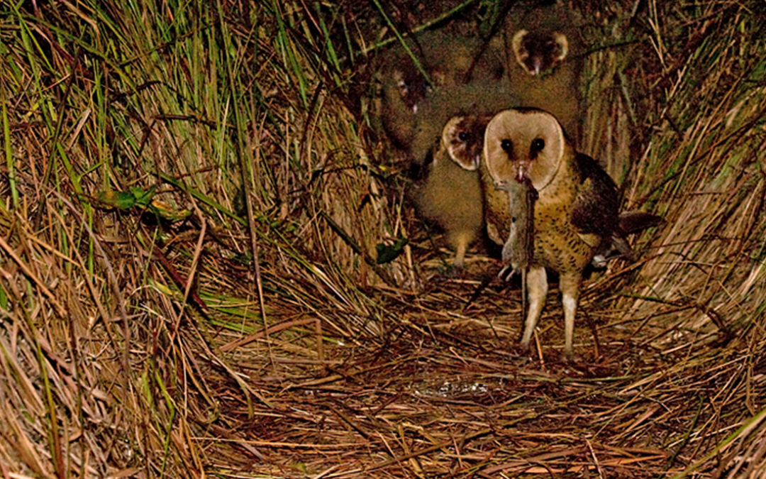
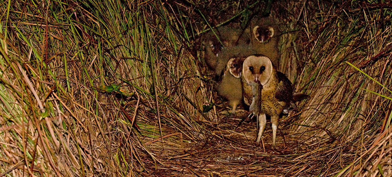
Dense Imperata cylindrica grass providing nesting habitat for an African Grass Owl

Habitat loss and degradation are among the greatest threats facing wildlife today. This is especially true for bird species that depend on specific environmental conditions for breeding.

Understanding where birds choose to breed and forage is therefore essential for effective conservation planning. When selecting a nesting site, birds consider factors at different scales. At the local scale, they may respond to conditions such as temperature, food availability, and protection from predators. At a broader landscape scale, factors such as vegetation type, habitat size, and the surrounding environment become important. For species that do not build their own nests, finding a suitable breeding site can be even more challenging.

The African Grass Owl is one of only two owl species in South Africa that lays its eggs on the ground, using nests concealed within dense grass or sedges. Despite this unique nesting behaviour, relatively little is known about how these owls choose their breeding sites. In a recent publication co-authored by EWT scientists*, researchers investigated which habitat features are most important in nest site selection by African Grass Owls.

African Grass Owls inhabit moist grasslands in South Africa. Because they do not construct their own nests and breed directly on the ground, suitable nesting habitat is critical to their survival. To better understand their nesting preferences, researchers tracked seven breeding females and monitored 41 nests in Gauteng and Mpumalanga between 2009 and 2017. By comparing nesting locations with the surrounding landscape, they were able to identify the characteristics that influence nest site selection.

The study revealed that African Grass Owls are extremely selective when choosing breeding sites. Within their entire home range, there may be only one location that meets all the requirements for successful nesting. Researchers also found that breeding pairs often return to previously used nest sites when suitable conditions remain unchanged.

One of the most important factors influencing nest selection was the presence of Imperata cylindrica, a grass species found at 88% of the monitored nests. The owls showed a strong preference for this grass over other available species and were observed leaving their territories if this particular species is not available. Imperata cylindrica is also highly susceptible to fire, which could further limit nesting.

The researchers also found that nests were most commonly oriented towards the east-southeast, with an average orientation of 102.16°. In addition, Grass Owls showed a strong preference for nesting near wetlands while avoiding developed areas. Avoiding developed areas may help reduce the risk of predation from domestic and feral cats and dogs, which pose a significant threat to ground-nesting birds. The owls also avoided cultivated fields, possibly because these areas support different prey species.

Agricultural fields are typically dominated by gerbils and other seed-eating rodents, whereas wetlands provide habitat for larger herbivorous rodents such as the vlei rat, one of the Grass Owl’s preferred prey species. Finally, the owls were found to avoid woodlands, mining areas, and urban environments. This behaviour may help reduce competition or conflict with other owl species, including the Barn Owl.

This study provides valuable insight into the breeding habitat requirements of the African Grass Owl, a species currently listed as Vulnerable on the IUCN Red List. The findings highlight the importance of conserving suitable nesting habitat if populations are to persist into the future.

Based on their results, the researchers recommend maintaining a mosaic of wetlands and moist grasslands that includes extensive stands of Imperata cylindrica. These areas should be protected through the use of firebreaks, while controlled burns should be conducted every three to six years to maintain suitable habitat. Ideally, a secondary patch of Imperata cylindrica should be managed alongside the main nesting area and burned on an alternating schedule to ensure that suitable nesting habitat is always available. The researchers also recommend limiting development within Grass Owl home ranges, excluding livestock from key breeding areas, and controlling invasive alien plants such as pom-pom weed. Together, these measures could help protect and restore the specialised habitats that African Grass Owls depend on for survival.

* Pretorius, M. D., Malan, G., Rachuene, T., Tate, G. J., Botha, A., Van Niekerk, A., Chetty, K. & Durgapersad, K. (2026). African Grass Owl nest site use and nest survival in fragmented grassland landscapes. African Journal of Wildlife Research, 56(1). https://doi.org/10.3957/056.056.0110


Camera Traps Monitor Bird Activity on Power lines

Camera Traps Monitor Bird Activity on Power lines

In the Field

Camera Traps Monitor Bird Activity on Power lines

By Amos Letsoalo, Wildlife and Nature Unit senior field officer


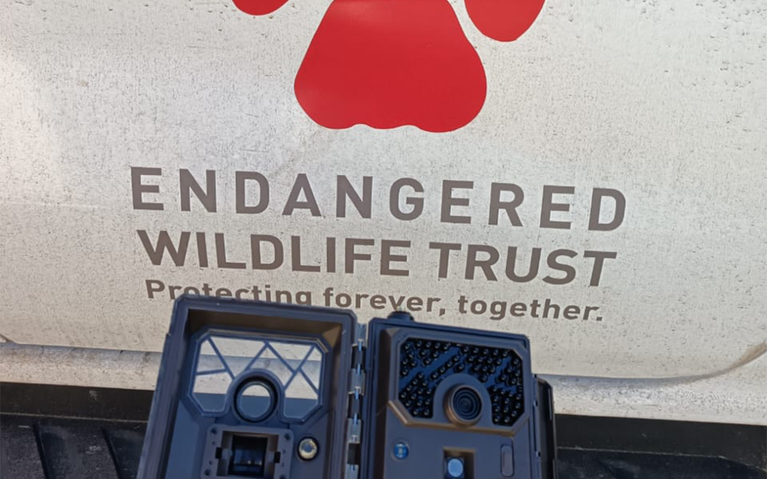
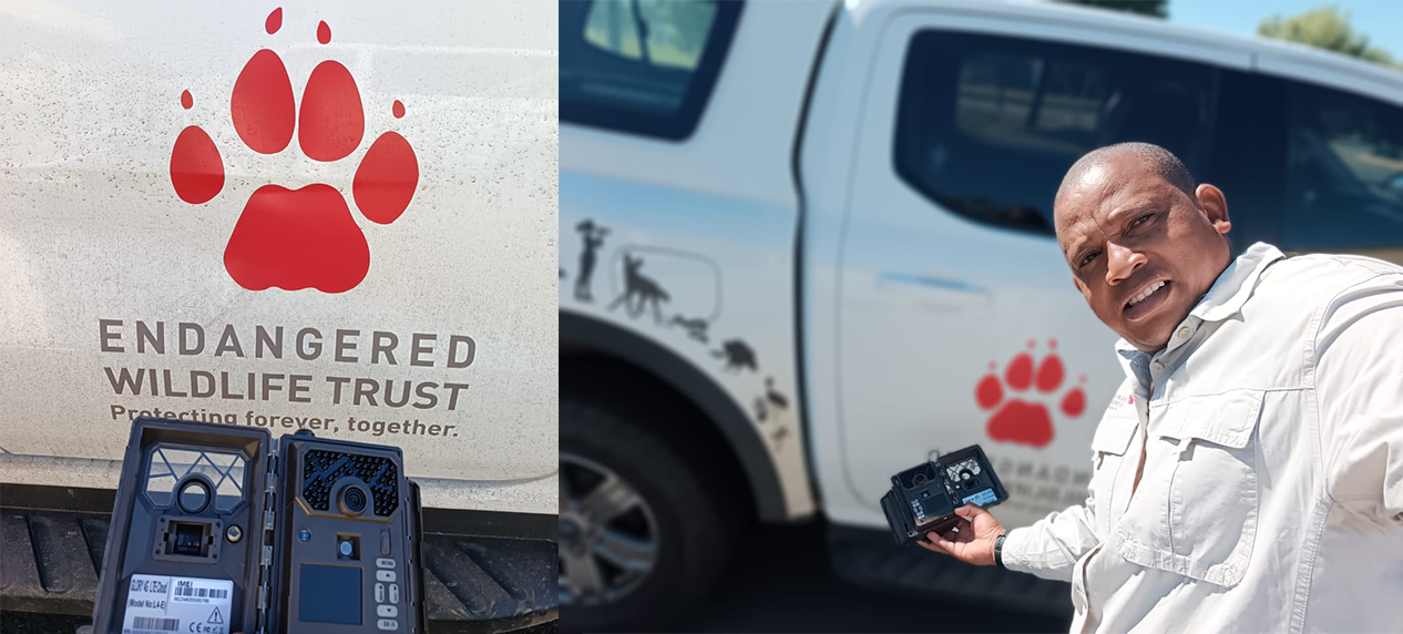
Wildlife monitoring camera installed on power infrastructure in the Northern Cape

The EWT’s Wildlife and Infrastructure Unit (WIN), in collaboration with National Transmission Company of SA (NTCSA), has installed camera traps on a power line within a nature reserve In the Northern Cape to understand incidents involving birds along this section of line.

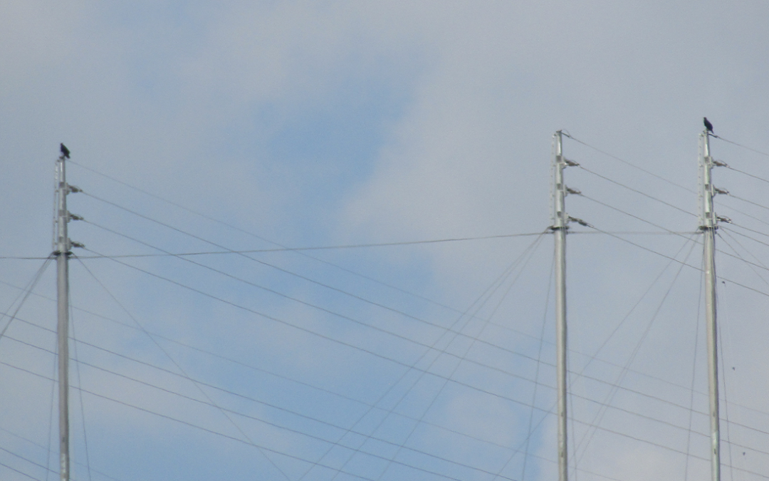
The use of camera trap technology will help us to monitor bird interactions with power infrastructure on a Boundary Olien 1 power line within the Dronfield Nature Reserve outside Kimberley.  This is because the power line has had several wildlife and electrical infrastructure incidents in the recent past, including vulture collisions.

Following the installation of three camera traps a few months ago, a fourth one was added to the line, to increase monitoring of the area. 

With these four technological eyes now monitoring the power lines, we hope to gather more data on how birds interact with the power lines. This   will not only help us better understand these interactions, but also assist us in applying relevant mitigation measures to minimise negative impacts on both wildlife and power lines and other electrical infrastructure.

Without this intervention the impact on vulture populations in the area will continue. The Wildlife in Nature Unit is appealing to the public to report any incidents involving power lines and electrical infrastructure to amosl@ewt.org so we can take the steps needed to protect the wildlife and power lines.


Painted Wolf Wines Lion Collaring Campaign passes halfway mark

Painted Wolf Wines Lion Collaring Campaign passes halfway mark

Painted Wolf Wines Lion Collaring Campaign passes halfway mark

By Eleanor Momberg


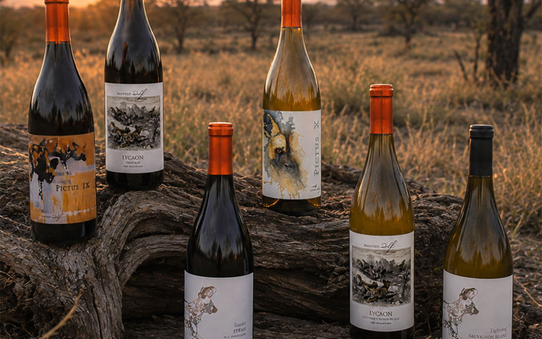
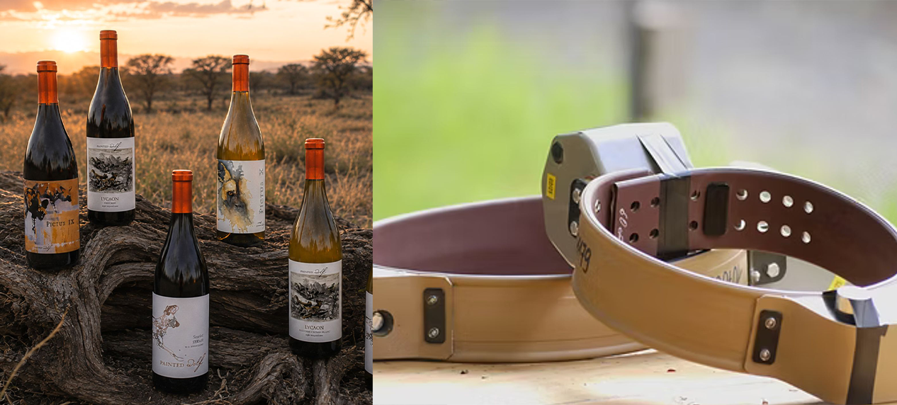
Painted Wolf Wines campaign raising funds for lion conservation in Kruger National Park

The Kruger Carnivore Funraiser, a six-month national campaign to rase R700.000 for carnivore conservation in and around the Kruger National Park has surpassed its halfway mark.

The campaign, launched in June by Painted Wolf Wines in partnership with the Endangered Wildlife Trust and the SANParks Honorary Rangers, had raised R355,344.00 by mid-August, for 11 collars for lion through the sale of 488 cases of wine, and two very generous cash donations.

The campaign responds to a stark reality: the lion population in the northern Kruger has declined by 63% since 2005, driven largely by targeted poaching for body parts; cheetahs have lost 90% of their historic range across Africa; and fewer than 6,600 African Wild Dogs remain on Earth.

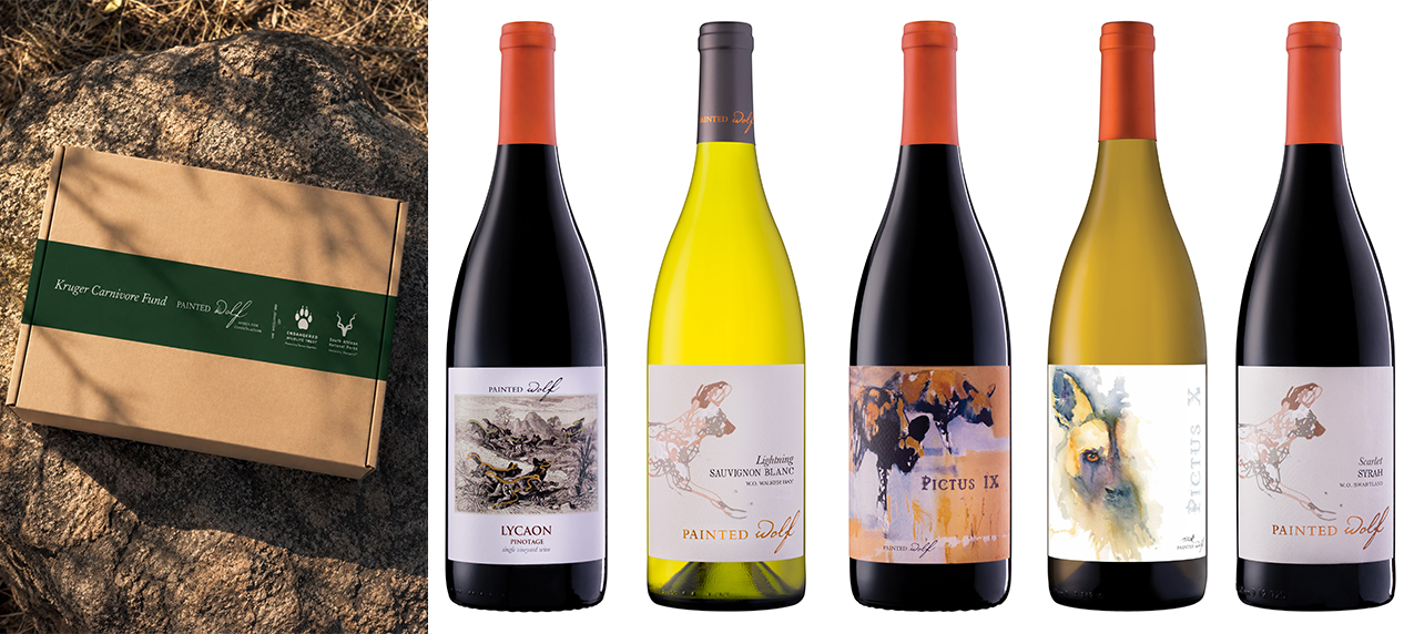
Painted Wolf Wines, marking its 20th harvest this year, has hand-selected and donated 6,000 bottles of its award-winning wines to the cause. Supporters purchase a limited-edition Kruger Carnivore Case of six premium wines (Platter’s 4–4.5 star / Tim Atkin 90+) for R995, against a retail value of more than R1,800. Of every case sold, R600 is donated directly to the SANParks Honorary Rangers for carnivore conservation, administered in partnership with the EWT. The balance of the R995 is purely for fulfillment costs with Painted Wolf Wines taking no profit or margin on these cases.

Funds will close a critical gap: 30 GPS collars are needed to monitor lions in the highest-risk areas of the northern Kruger National Park. 10 have been funded; the campaign aims to fund the remaining 20. Each collar costs R35,500 and provides two years of satellite monitoring, enabling rangers to track pride movements in real  time and respond before poaching incidents occur. A single collared lion provides indirect protection to its entire pride.

The EWT’s Carnivore Conservation Unit manager, Derek van der Merwe, says satellite collars are an essential conservation and law enforcement tool, providing far more than simple location data.

“They enable conservation teams to detect abnormal movement patterns or mortality signals that may indicate a lion has been caught in a snare, poisoned, or otherwise injured. This allows rapid deployment of field teams and veterinarians, significantly increasing the likelihood of rescuing injured animals before they succumb to their injuries”.

In cases of poisoning, he says, collars provide an early warning that enables teams to respond before additional wildlife is affected. Poisoned carcasses often attract scavengers, including vultures, hyenas, jackals, and other carnivores, resulting in devastating secondary mortalities.

Derek says rapid detection and removal of poisoned carcasses can therefore prevent the loss of dozens or even hundreds of additional animals, particularly threatened vulture species.

Satellite collars also play a critical role in supporting law enforcement.

“By enabling conservation teams to reach incident sites quickly, they improve the chances of identifying evidence, securing crime scenes, and working with law enforcement authorities to apprehend those responsible for illegal activities such as snaring and poisoning. Prompt responses not only increase the likelihood of successful prosecutions but also act as a deterrent to future wildlife crime,” he says.

Beyond emergency response, collar data informs proactive conservation management by identifying areas where lions are at greatest risk of human-caused mortality. This information allows managers to target anti-poaching patrols, engage with neighbouring communities, mitigate emerging conflict hotspots, and implement preventative interventions before further incidents occur.

For these reasons, the collaring remains one of the most effective tools available for reducing anthropogenic lion mortality, protecting associated biodiversity, and improving the effectiveness of both conservation management and wildlife law enforcement.

“Satellite collars also play a vital role in preventing human-lion conflict,” says Derek. “Real-time movement data enables conservation teams to identify when lions leave protected areas or begin moving towards neighbouring communities, livestock grazing areas, or other high-risk conflict zones. This allows rapid intervention through aversive conditioning, herding lions back into protected areas, or, where necessary, physically relocating animals before conflict occurs”.

These proactive responses substantially reduce livestock losses, improve human safety, minimise retaliatory killing of lions, and foster greater tolerance for large carnivores among affected communities. By preventing conflict before it escalates, satellite collaring is an important tool for promoting long-term coexistence between people and lions while reducing the need for reactive management interventions.

Painted Wolf Wines’ Madison Keyser says every case purchased earns the buyer automatic entry into monthly prize draws, featuring safari stays, culinary experiences, art and merchandise donated by campaign prize partners — culminating in a Grand Prize Draw in December 2026.

The campaign carries a particular symbolic weight: it unites the Kruger National Park’s 100th anniversary, the SANParks Honorary Rangers’ 60 years of volunteer service, and Painted Wolf’s 20th harvest.

Jeremy Borg, Painted Wolf Wines founder, says: “Twenty years ago we founded Painted Wolf on the belief that exceptional wine could keep wilderness wild. In the Kruger’s centenary year, with its great carnivores under real pressure, this is the most important campaign we have ever run. Every case sold puts R600 directly into protecting our carnivores and we are asking South Africa’s wine lovers to join the cause.”

Painted Wolf Wines and EWT campaign supporting lion conservation and wildlife protection

Availability

The Kruger Carnivore Case is available from 1 July 2026 (domestic delivery included, use Kruger2026 to activate in the coupon code box; international shipping at additional cost).

The campaign runs to December 2026, with prize draws at the end of each month and the Grand Prize Draw on 16 December 2026.

Campaign at a glance:

  • Goal: R700,000 for carnivore conservation in and around Kruger National Park
  • Mechanic: 6,000 donated bottles; six-bottle case at R995 (retail value R1,800+)
  • Donation: R600 per case (R100 per bottle) to the SANParks Honorary Rangers, administered with the EWT
  • Purpose: fund 20 GPS lion collars at R35,500 each (two years of satellite monitoring per collar)
  • Dates: 1 July – December 2026; monthly prize draws; Grand Prize Draw 16 December 2026
  • Partners: SANParks Honorary Rangers, Endangered Wildlife Trust and thanks to all our prize Partners.
A Running Chance for Wildlife

A Running Chance for Wildlife

A Running Chance for Wildlife


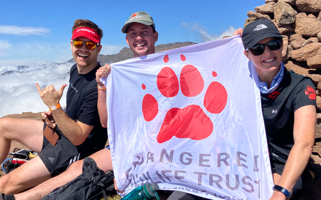
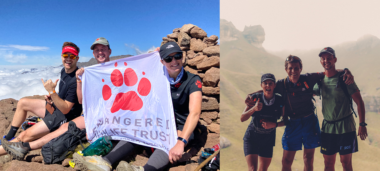
Rhino Peak Challenge participants running in Drakensberg mountains

On 19 September 2026, 48 Endangered Wildlife Trust and Wildlife ACT ambassadors will be taking on the 11th Rhino Peak Challenge in the Maloti-Drakensberg Park World Heritage Site to raise money for conservation.

This bold group of conservationists, running and climbing enthusiasts, have joined an annual event that is dedicated to make a difference in nature and the environment.  Participants take on the 21 km challenge to reach the top of the 3,056 m Rhino Peak in the name of raising money for specific conservation projects to conserve cranes, rhinos and vultures.

With the race fast approaching, the EWT’s team, led by Tammy Baker,  is inviting those who love the outdoors and believe that individuals can make a difference in our natural world, to join us for the adventure.   There are still several spots available for those feeling up to the challenge.  If not this year, then consider next year.

In three weeks Tammy will be taking on the Rhino Peak Challenge for the 8th year in a row. The EWT’s team includes an intrepid collection of “desk jockeys” (the finance team), conservationists (the Midlife Crisis), friends and dedicated supporters of our conservation ethic.

The Rhino Peak Challenge (RPC)  conservation fundraiser raises funds for the EWT, Wildlife ACT and the Bearded Vulture Recovery Programme.    In the past decade more than R10 million has been raised through the RPC.

Tammy says beyond the physical test, the Rhino Peak Challenge offers an unforgettable weekend of adventure, camaraderie, and purpose. To secure one of these exclusive ambassador places, you have the privilege of raising a minimum of R20,000 in support of conservation. In return, you’ll enjoy a fully hosted weekend experience and the chance to be part of one of Southern Africa’s most inspiring conservation fundraising events.

Participation is deliberately limited to create a truly special experience for those involved, bringing together like-minded people who are passionate about protecting Africa’s natural heritage while making a tangible impact for conservation.

If this sounds like something you’d like to be part of, we’d love to hear from you.

To find out more, please contact Tammy at the Endangered Wildlife Trust at tammyb@ewt.org