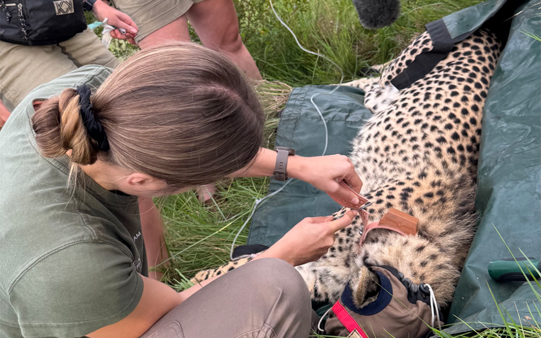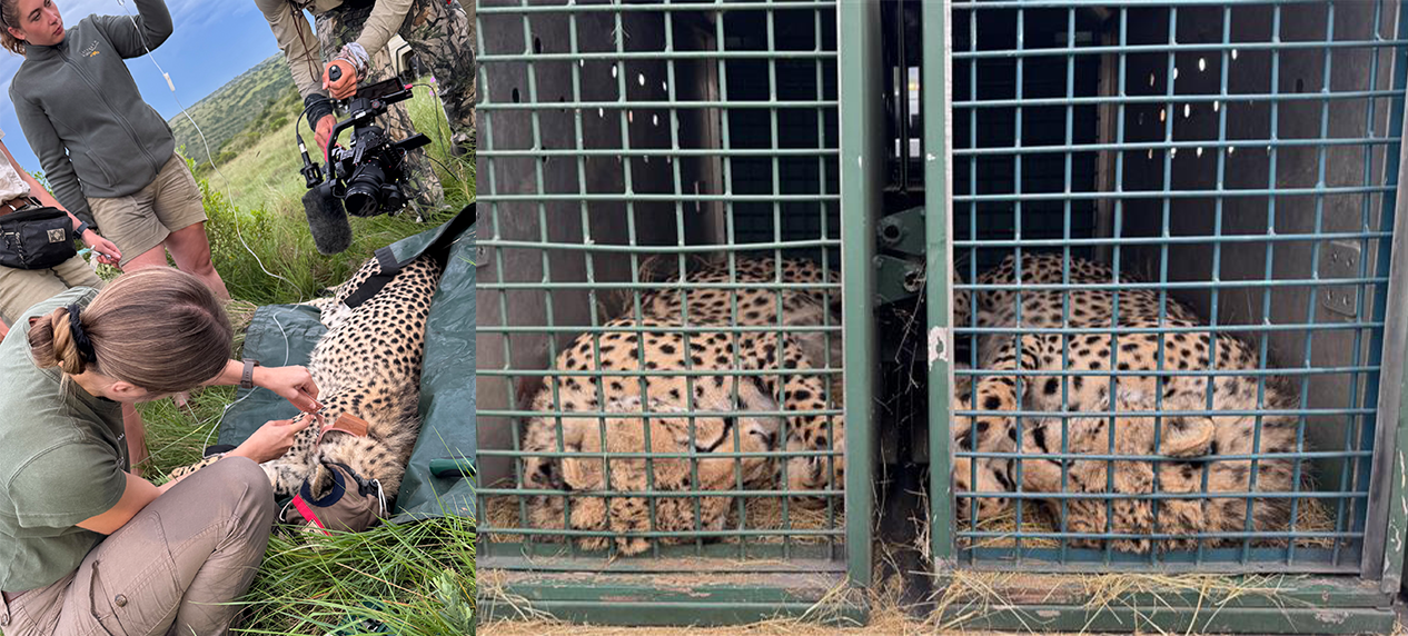
Left: Collaring. Right: Cheetah during transport
In March, members of the Carnivore Conservation team’s Cheetah Range Expansion Project embarked on a significant cheetah relocation from the Eastern Cape to Mpumalanga—but that’s just part of the story.
In collaboration with the Mpumalanga Tourism and Parks Agency (MTPA), we’ve been working for some time to expand the cheetah range across the province through the reintroduction of the species into suitable areas.
In 2023, the Ukuzwana reserve in Mpumalanga was identified as a key restoration site for this project—the first of many steps in this larger initiative.
Ukuzwana Witbad Foundation is a newly established initiative with conservation at its core. Its mission is to protect and preserve the entire ecosystem—from trees and insects to fish, antelope, and carnivores.
After over a year of tireless efforts by all involved, particularly the MTPA scientists and the Ukuzwana team, in December 2024, we were finally ready to select suitable cheetahs for reintroduction.
Around this time, Lalibela Game Reserve in the Eastern Cape had two male Cheetahs disperse. Born and raised in Lalibela, they were accustomed to open plains and had grown up hunting blesbok. However, they also posed a high risk of inbreeding, making it crucial for us to find them a new home and assist in their dispersal from their natal reserve via translocation. Ukuzwana, with its expansive grasslands and a population of over 1,500 blesbok, was clearly the perfect place for them.
When the time was right, I began the long journey to Lalibela to capture and relocate these males to Ukuzwana.
Fifteen hours, a few brief stops, and a couple of wrong turns later, the cheetahs arrived safely in Mpumalanga and were offloaded at their new home.
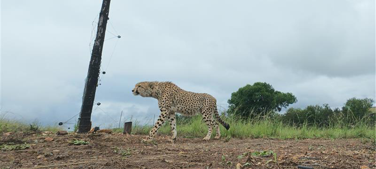
Cheetah leaving the boma
As with most translocations, they were first released into a boma. This allowed them to settle into their new surroundings, getting used to the sights and smells of their new home after the long journey.
But soon their restlessness set in—they were already attempting to hunt any bird that ventured into the boma. It was clear that the time for release had come! Four weeks after their arrival in Ukuzwana, the boma gates were opened, and within 30 minutes, the brothers eagerly set off to explore their new territory.
Since then, we’ve been keeping a close eye on them and are thrilled to report that both cheetahs have settled in wonderfully, successfully hunting within their first 12 hours of release!
Ukuzwana is now the second reserve in Mpumalanga, outside of the Greater Kruger area, to offer a safe haven for wild Cheetahs. This marks a significant milestone in the species’ restoration within the province.
“As a young organisation, we are honoured to be partnering with the Endangered Wildlife Trust through the Cheetah Range Expansion Project. Becoming only the second reserve in Mpumalanga to host cheetahs is a proud moment for us, and one that marks the beginning of our journey in supporting this critical conservation effort. We’re excited to walk this path together and contribute to a future where wildlife thrives,” the owners said shortly after the arrival of the cheetah.
The EWT are excited to continue its collaboration with MTPA and Ukuzwana on cheetah conservation and look forward to introducing a female soon to establish a breeding population. Together, we’re making crucial strides to ensure the Cheetah’s future in Mpumalanga and beyond.
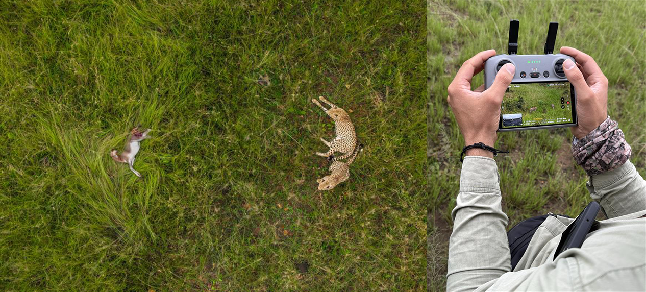
Drone monitoring