South Africa stands at a critical crossroads. Decades of unsustainable land use, combined with intensifying climate pressures, have pushed some of the country’s most important ecosystems to the brink.
Grasslands that supply the majority of the nation’s water, savannas that support iconic wildlife and rural livelihoods, and thicket systems unique to the Eastern Cape now show the accumulated scars of overgrazing, mining, invasive alien plant encroachment, drought and fire.
But, alongside this sobering reality lies a growing movement—one that is evolving from scattered localised rehabilitation efforts to coordinated, large-scale action capable of transforming entire landscapes. At the centre of this shift is ReLISA: Restoring Landscapes in South Africa, a five-year, €15-million initiative funded by the German Federal Ministry for the Environment (BMUV) through the International Climate Initiative (IKI).
ReLISA brings together an exceptional consortium—United Nations Environment Programme (UNEP), the Endangered Wildlife Trust (EWT), the United Nations Development Programme (UNDP), the United Nations Educational, Scientific and Cultural Organisation (UNESCO), Council for Scientific and Industrial Research (CSIR), C4 EcoSolutions and Unique Landuse—with the aim to develop large-scale restoration initiatives, expand protected areas and drive social inclusivity.
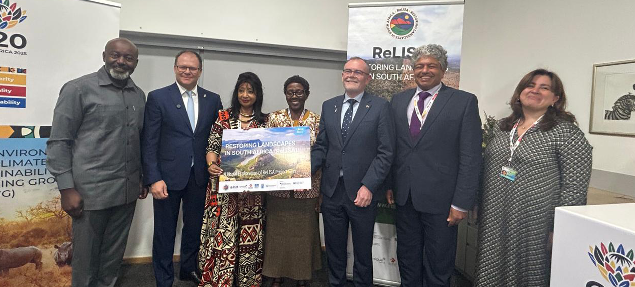
On 16 October, on the sidelines of the G20 Environment and Climate Sustainability Working Group (ECSWG) Ministerial Meeting in Cape Town, the ReLISA project was jointly officiated by Dion George, South Africa’s Minister of Forestry, Fisheries and the Environment (DFFE); Carsten Schneider, German Federal Minister for the Environment, Climate Action, Nature Conservation and Nuclear Safety (BMUKN); Elizabeth Maruma Mrema, Deputy Executive Director of the United Nations Environment Programme (UNEP); and Nelson Muffuh, Resident Coordinator of the United Nations in South Africa.
ReLISA is not just another conservation project. It is a strategic intervention designed to unlock private and public investment, drive protected area expansion and place nature-based solutions at the heart of national development priorities. It marks a new generation of restoration programming—one that pairs ecological restoration with economic valuation, financial innovation, and strong community partnerships.
At the heart of the initiative lies a simple but powerful premise: restoration is not only good for nature—it is good for people, economies, and long-term climate stability.
Healing Biomes That Sustain a Nation
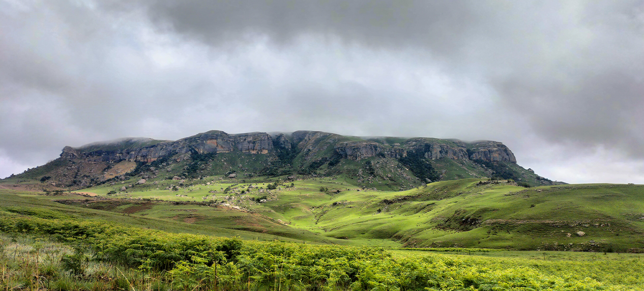
South Africa’s landscapes are globally celebrated for their richness and diversity. Yet three biomes, in particular, stand out for their ecological and economic importance. ReLISA’s core areas of focus are the Grassland, Savanna and Thicket Biomes. These landscapes have absorbed the impacts of generations of intensive use. Today, they face additional threats from climate change—prolonged droughts, record-breaking temperatures, wildfires and shifting rainfall patterns. Meanwhile, invasive alien plants continue to spread at unprecedented rates, outcompeting indigenous vegetation and consuming critical water supplies.
Decades of land degradation, notably within Strategic Water Source Areas (SWSAs), have undermined biodiversity, strained water security, and eroded the natural assets that rural communities depend on. As climate change intensifies, the impacts of droughts, extreme weather, and land degradation are becoming more severe, especially for vulnerable households and farmers. This project emphasises the importance of SWSAs in South Africa, which are critical for maintaining water supply whilst supporting agriculture, communities, and wildlife. By focusing restoration work within, and protecting, SWSAs, water retention in the landscape can be enhanced, erosion reduced and the resilience of ecosystems in the face of climate change improved.
At the same time, governments and land users have consistently faced a barrier common to restoration efforts worldwide: how to finance restoration at scale. The project aims to bridge this gap by combining biophysical science with economic valuation and investor-ready project design, building a compelling economic case for restoration in South Africa in order to attract private investment and blended finance opportunities.
ReLISA recognises that restoring these biomes is no longer optional; it is essential. Not only for safeguarding biodiversity, but for national water security, economic resilience, climate adaptation and the well-being of communities who depend directly on the land.
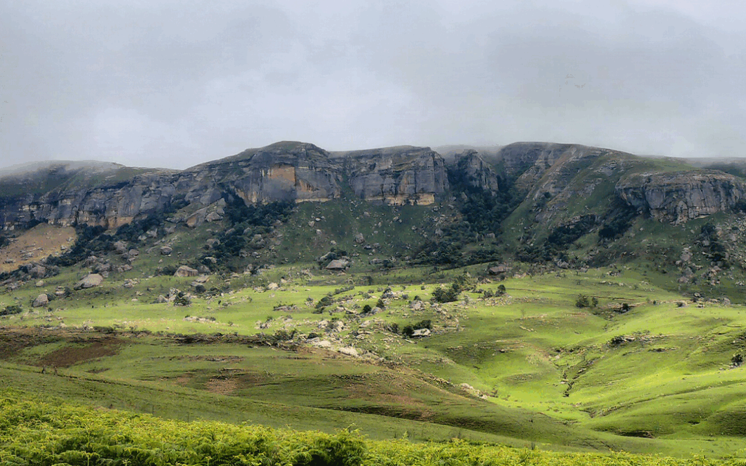
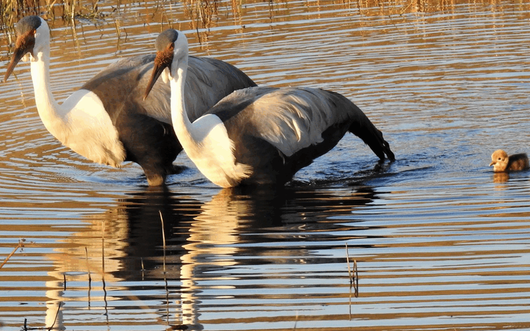
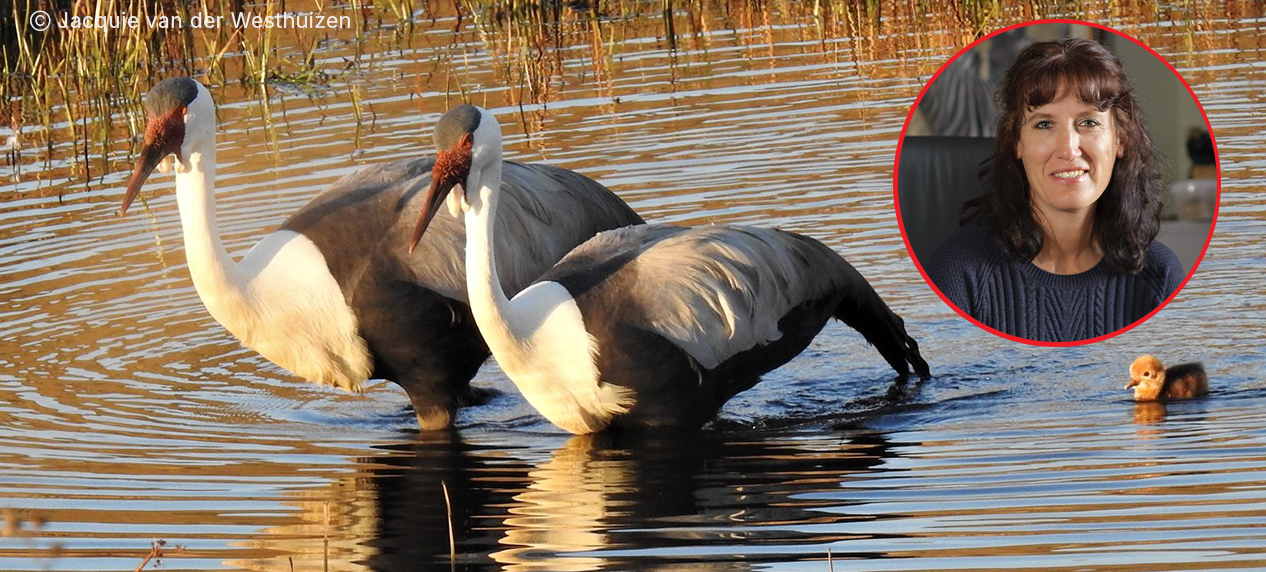
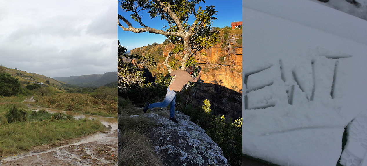
The main target landscapes for the EWT within ReLISA are the Northern Drakensberg, Soutpansberg and the Amatholes. Within these, the EWT strives to further expand the existing protected area network through biodiversity stewardship mechanisms, whilst addressing land degradation and species conservation. Within each of the landscapes there is a dedicated and committed field officer who actively works alongside land users, building relationships and providing input and assistance with rangeland management, restoration and alien plant clearing. The work undertaken within these landscapes is more than just protected area expansion for the sake of numbers, it focusses on key corridors, areas of intact habitat and properties where there are known threatened species, with the aim to create a larger, connected network of protected areas.
What ReLISA Aims to Achieve
The true innovation of ReLISA is its systems thinking. Instead of treating restoration as isolated interventions, the project views landscapes as interconnected ecological, social and economic systems.
- Restoration at Scale
ReLISA aims have 100,000 hectares across key landscapes under restoration by 2030, biomes that are essential for biodiversity, water supply, and climate resilience.
- Expansion of Protected Areas and the Northern Drakensberg Biosphere Reserve
In conjunction with the expansion of protected areas, the EWT is in the very early stages of setting up the proposed Northern Drakensberg Biosphere Reserve, targeting the grassland biome and incorporating existing protected networks along the northeastern escarpment between Royal Natal National Park and Memel in the eastern Free State.
- Economic and Financial Innovation
ReLISA is developing bankable business models for restoration, creating opportunities for impact investors, agribusiness, and other private sector actors to finance nature-based solutions. Funding models include payments for ecosystem services, carbon-focused finance through carbon credits, and potential water-fund mechanisms.
- Strengthened Ecosystem Services
Restoration activities will improve water security, stabilise soils, restore carbon stocks, and enhance biodiversity. These improvements directly support local livelihoods, agriculture, and tourism.
- Policy Support and Knowledge Sharing
Through strong collaboration with government partners, ReLISA will support policy development and share insights nationally and internationally, helping shape a long-term, sustainable restoration economy.
Looking Ahead
As climate risks accelerate and water security declines, the cost of inaction grows each year. Yet restoration—when done at scale—offers one of the highest returns on investment of any nature-based solution.
With its official launch complete, ReLISA now moves into full implementation. The coming years will focus on expanding restoration efforts, deepening community partnerships, and demonstrating that nature-based solutions can deliver economic, ecological, and social benefits at scale.
Through strong collaboration, innovative financing, and evidence-based action, the project seeks to become a flagship model for sustainable restoration—not only in South Africa, but globally.