How drones are taking conservation and wildlife management to new heights
Join the Endangered Wildlife Trust’s Matt Pretorius as he talks about how drones have been integrated into conservation activities in South Africa, the challenges and limitations encountered, and the opportunities still to explore. You can also book for a scrumptious dinner after the talk as well!
RSVP by 9 April to rebeccam@ewt.org.za or 011 372 3600
Dinner reservations must be booked and paid in advance by the RSVP deadline
Dinner & Talk
18:30 for 19:00
Dinner to be served at 20:15 |
|
|
Dress Code
Smart Casual
No shorts, t-shirts, or flip-flops |
|
|
EWT Members
R100 pp talk only
R300 pp dinner & talkNon-Members
R120 pp talk only
R320 pp dinner & talk
R200 pp dinner only |
|
|
CCJ Members
R100 pp talk only
R300 pp dinner & talkCCJ Members RSVP
Nikki@ccj.co.za
011 710 6406
Charges will be made to your Club Account |
|
|
Abstract:
Less than a decade ago, remotely piloted aircraft systems (RPAS), or drones, were a novelty in South Africa. They had fewer high-tech features, batteries were bulky and inefficient, with pilots satisfied with a 12-minute flight. Drone technology and capabilities in 2022 are vastly improved, with smart, artificial intelligence-enabled features, anti-collision devices, stronger motors, more efficient and safer batteries, heavier payload capacities, and a vast array of compatible cameras and sensors. Moreover, much of this technology now comes standard in consumer-level drones, allowing us to do more for much less.
For conservation practitioners, the most useful attribute of drones has remained the same – they provide an aerial perspective of different environments and wildlife within those environments that are difficult to access on the ground. So, how have drones been integrated into conservation and wildlife management activities in South Africa? What are the limitations and challenges to using drones in conservation, and what is the future of the industry? In this presentation, Matt Pretorius will explore these topics from the perspective of a conservation scientist and legal drone operator for the Endangered Wildlife Trust (EWT).
Presenter bio:
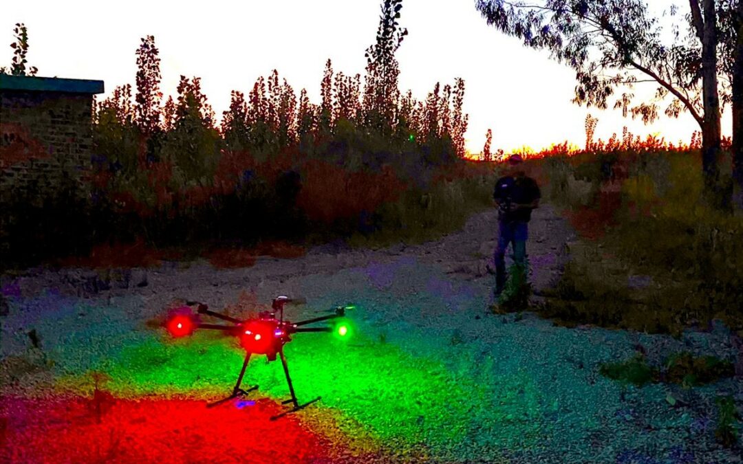
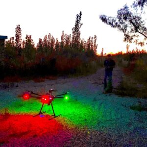
Matt studied nature conservation at the Tshwane University of Technology, which included experiential training in the Kgalagadi Transfrontier Park. There he developed a passion for owls and other raptors, and this led him to pursue a postgraduate study on African Grass Owls with the EWT’s Birds of Prey Programme. That was 14 years ago, and Matt has been with the EWT ever since, having made an internal switch to the Wildlife and Energy Programme in 2014. Matt’s training throughout his career has been largely experienced-based, and he has been exposed to a wide spectrum of practical, applied conservation projects. His more recent research has adopted a more experimental approach, testing the validity of current avian protection measures using robust data collection and analysis methods. These studies are not just intended to protect birds, but to ultimately improve electricity transmission and distribution performance, thereby helping to keep the lights on for South Africans. Matt is also a licensed drone pilot and has flown several conservation-oriented missions for the EWT since it became a legal operator in January 2021.
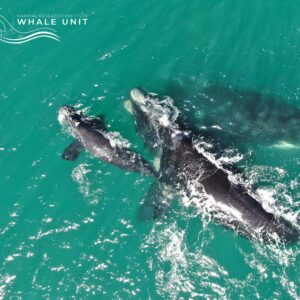
MRI Whale Unit Research: Drones Revolutionise Whale Conservation
The MRI whale unit research partnership between the Endangered Wildlife Trust and University of Pretoria is transforming how we study Southern Right Whales. Using cutting-edge drone technology, researchers can now assess whale body conditions and behaviour patterns in a cost-effective, non-invasive manner – critical for understanding climate change impacts on marine ecosystems.
Drone Technology Breakthroughs
The EWT’s licensed drone operations (SACAA-approved since 2020) are enabling groundbreaking conservation work:
- Power line safety: Attaching bird flight diverters
- Wildlife monitoring: Thermal imaging for nocturnal animal counts
- Marine research: Photogrammetry of whale populations
Southern Right Whale Research
The unit employs specialised drones to:
- Capture high-resolution aerial images
- Measure body condition indices (BCI)
- Track individual whales over time
- Compare populations across South Africa, Australia and Argentina
“Drone technology has revolutionised our research,” says Dr Els Vermeulen, MRI Whale Unit Research Manager. “We can now track body condition variations annually and observe behaviours invisible from boats.”
Climate Change Connections
The research highlights worrying trends:
- Krill populations (whales’ main food) affected by ocean warming
- Declining body conditions may indicate ecosystem stress
- Long-term data crucial for conservation planning
How to Get Involved
Contact Lourens Leeuwner (lourensl@ewt.org.za) for drone operation enquiries
TECHNOLOGY TAKING CONSERVATION TO NEW HEIGHTS
Matt Pretorius, Wildlife and Energy Senior Field Officer and RPAS pilot, mattp@ewt.org.za Whether used as toys or tools, drones are no longer a novelty. Coupled with advances in artificial intelligence (AI), drones now have a role to play in most industries, and the scope of our imagination is the only limitation. Drones deliver much-needed medicine to remote communities; scan compromised infrastructure for survivors during emergency disaster response; facilitate smart agriculture; and drop small explosives for the controlled triggering of avalanches, as just a few examples. Of course, there are more sinister potential uses for drones, from spying on your neighbour to so-called ‘slaughterbots’ – terrifying autonomous microdrone assassins with Artificial Intelligence for facial recognition. The latter may sound far-fetched; however, the line between science and science fiction may not be so cut-and-dry when it comes to drones.
Imagine what this technology could mean for conservation? Well, in truth, it has already shaped the future of our industry. Drones have been used in various scientific studies, from detecting rare animals and counting colony-nesting birds to mapping habitats and creating 3D scans of trees. The main practical advantage of a drone is its ability to go places that humans and their traditional modes of transport can’t, and the most significant benefit is that it can safely perform the same tasks by eliminating the need for people to get into dangerous situations. For people working in conservation, these benefits apply not only to airborne activities but also to those conducted in places that are hazardous for humans.
Perhaps one of the best recent examples came in early 2020 when an Endangered Griffon Vulture was killed when she collided with a power line in Israel. Conservationists monitoring the chick she had been rearing needed to find a safe way of feeding it in its mountain top nest, which was completely inaccessible on the cliff face. With the help of a technology start-up and the military, a ‘mama drone’ was deployed to deliver food to the chick, effectively rearing it until it fledged successfully. While the benefit of using the drone was significant in terms of human safety, the project ticked another box: eliminating the need to take the bird out of its natural environment to save it.
But how do wild animals respond to these flying intruders? Is it ethical to use a drone to get close to an animal when it results in a stress response? Perhaps the better question is whether using a drone is less or more detrimental to the animal than current/traditional methods. These questions must be considered before undertaking any new conservation project using drone technology.

In South Africa, drone systems are formally known as remotely piloted aircraft systems (RPAS). Realising the variety of use cases for RPAS in conservation, the Endangered Wildlife Trust set out to become a legal drone operator in South Africa in 2017. The non-profit, corporate, and commercial use of drones is regulated by the South African Civil Aviation Authority (SACAA), and organisations looking to operate within the legal framework enforced by the SACAA must obtain an RPAS Operating Certificate (ROC). Getting an ROC is quite onerous in terms of the various licences, registrations, and certifications an organisation must acquire – so much so that, unfortunately, many drone pilots are put off by this process and choose to operate illegally. The long road to obtaining an ROC culminates in a base inspection and a demonstration of operational competency. We were delighted to have passed ours in December 2020 and received our ROC in January 2021 (ROC # G1397D). An ROC holder can only operate within its operational specification, which defines the general parameters of when, where, and how it can operate its RPAS. In addition to this, a letter of intent to the SACAA, the first step of the ROC process, further specifies the activities and services a ROC holder can provide. Thus, when we started the ROC process in 2017, we had to think very carefully about all the possible applications that would fit our mandate as a conservation organisation and the uses for RPAS that would benefit the EWT in general. In the end, we opted to keep the services listed on our letter of intent broad enough to encompass a wide variety of conservation activities:
- Surveys for birds, bird nests, and mammals for conservation purposes.
- Topographical and vegetation surveys.
- Provide aerial support to conservation teams during operations.
- Assist authorities in locating injured animals, carcasses, poisoning, and poaching incidents.
- Inspect and photograph electrical infrastructure for maintenance and survey purposes.
- Use RPAS to elevate telemetry antenna to locate wildlife fitted with tracking devices.
- Attach anti-collision devices to linear electrical infrastructure (using a system developed with the help of Eskom-Research, Development and Testing)
- Operational assistance during electrical infrastructure maintenance.
- Aerial photography and videography.
- Assisting specialists with surveys relating to Environmental Impact Assessments and related audits.
We were pleased to have the opportunity to put our tech to good use in January when we provided aerial imagery support to the Gauteng Department of Agriculture and Rural Development (GDARD) for the continuous monitoring of a Hippopotamus seen moving in and around residential areas in northern Johannesburg. The EWT worked with the conservation authorities to locate and monitor the Hippo’s movements to ensure that it made its way to less populated areas safely, without coming into conflict with the area’s residents.
Should you require the services of the EWT’s drone unit for any of the activities listed above, please get in contact with our RPAS Operations Manager, Lourens Leeuwner (lourensl@ewt.org.za). Our RPAS are always ready to take flight for conservation.
