Help protect Africa's 

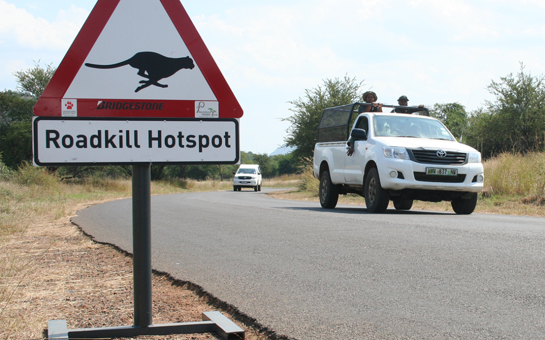
Roadkill remains a problem along South Africa’ s major transport corridors

Roadkill remains a problem along South Africa’ s major transport corridors


Roadkill remains a problem along South Africa’ s major transport corridors

By Thabo Hlatshwayo, Wildlife and Transport Project: senior field officer, Endangered Wildlife Trust.
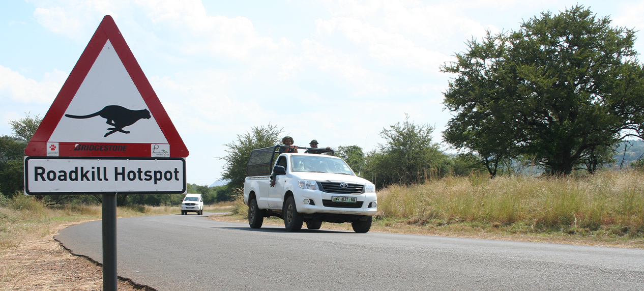
 

Although monitoring of the ecological impacts of transport infrastructure on biodiversity is still an emerging field of science in South Africa, it remains poorly supported in terms of funding. This is despite the fact that roads are responsible for the massive loss of biodiversity.

To determine the extent of roadkill in South Africa, the Endangered Wildlife Trust (EWT) has been facilitating and supporting various road ecology research since 2011. From the data that we have gathered, it is clear that roadkill is prevalent.

South Africa’ s road network covers around 750,000km. Our database on roadkill for the BAKWENA N1/N4, TRAC N4 and N3 toll routes indicates that a total of 8,569 records of wildlife roadkill incidences were reported from the three toll companies combined between 2012 and 2024. This is an increase of 1,565 from the roadkill magnitude reported in 2023, meaning that these animals were victims of roadkill on the toll route in 2024.

This emphasises the need for advancing biodiversity loss accounting in the transportation sector and crafting national transportation policies that are ecologically sustainable and support just transitioning to green transportation in South Africa. Supporting research on understanding how our road systems impact threatened habitats, habitat use and movement by animals is critical.

The construction and operation of transport corridors, such as roads and railways, have a range of both direct and indirect negative impacts on wildlife and natural ecosystems. Clearing natural landscapes for the construction of transport infrastructure causes vegetation cover loss, often leading to degraded landscapes. In the 28 years up to 2008, South Africa reportedly lost 0.12% of its natural vegetation cover per year as a result of massive linear infrastructure development, including transport corridors. Thus, all these contributed to landscape fragmentation, reduced land cover and connectivity loss for wildlife. It is interesting to note that the country’ s roads  stretch through sensitive habitats and wildlife hotspots, some of which are home to Threatened Species.

Habitat loss because of fragmentation is a primary threat to terrestrial biodiversity and could drive species extinction as it affects numerous endemic species. The fragmentation of a landscape limits the migration rates of species and its available habitat. Besides affecting migration patterns, it also contributes to inbreeding because species’ behavioural patterns, such as hunting, foraging, breeding and other home range activities have been disrupted. Habitat loss and fragmentation, because of transport corridors, also increases human-wildlife interactions. This leads to human-wildlife conflicts as animals are forced to cross roads for dispersal and migration. This further accelerates biodiversity loss through increased wildlife roadkill incidents, and numerous threatened species suffer the greatest risk from roadkill.

Small-to-medium sized mammals such as Serval, African Striped Weasel, Cape Clawless Otter, Honey Badger, Cape Porcupine, Cape Fox, African Wild Dog, several antelope and mongoose species are the most impacted mammal species. The reptiles that are most affected include Southern African Python, Puff Adder, Leopard Tortoises, Natal-hinged Tortoises, and Monitor Lizards. Among bird species, owls are the most affected, this includes the African Grass Owl, Barn Owl, Spotted-Eagle Owl and Marsh Owl.
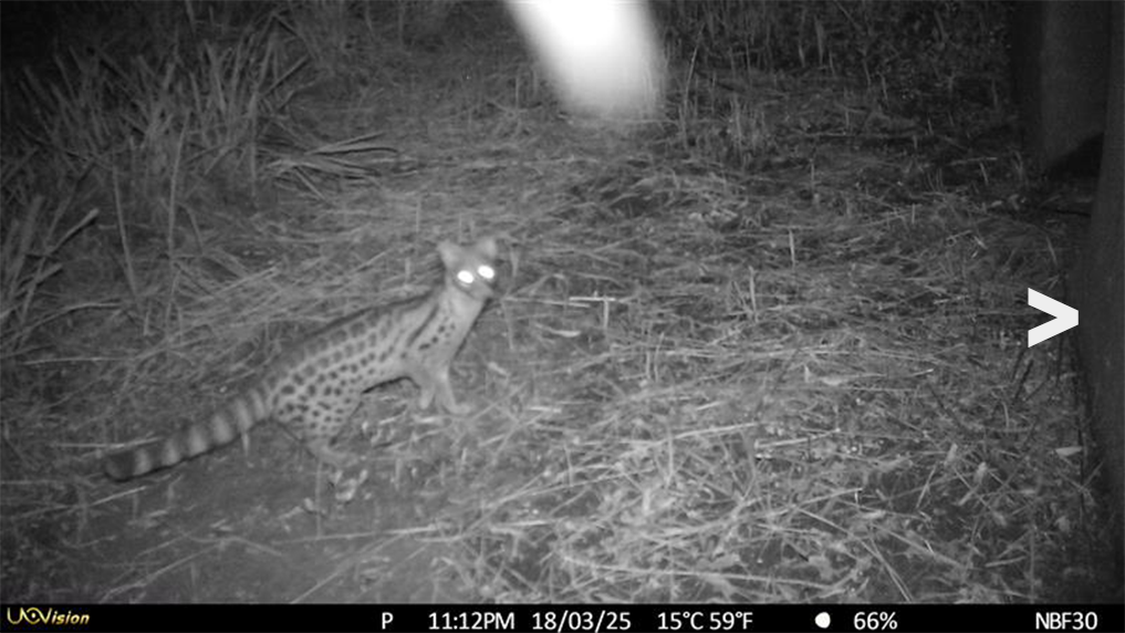
 

Genet
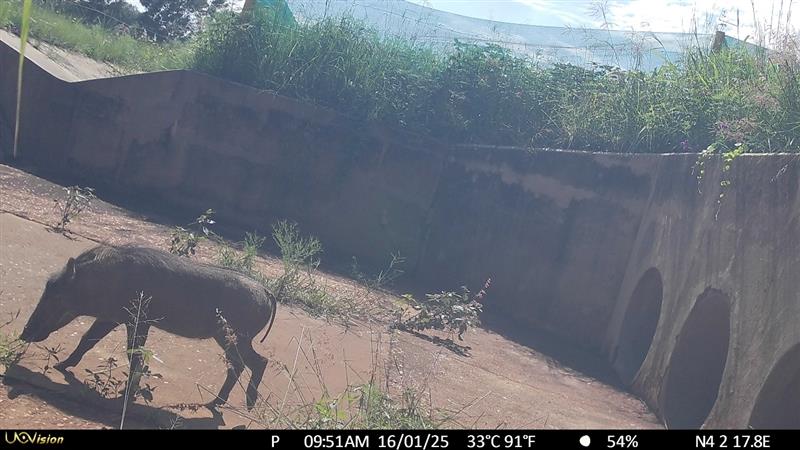
Warthog
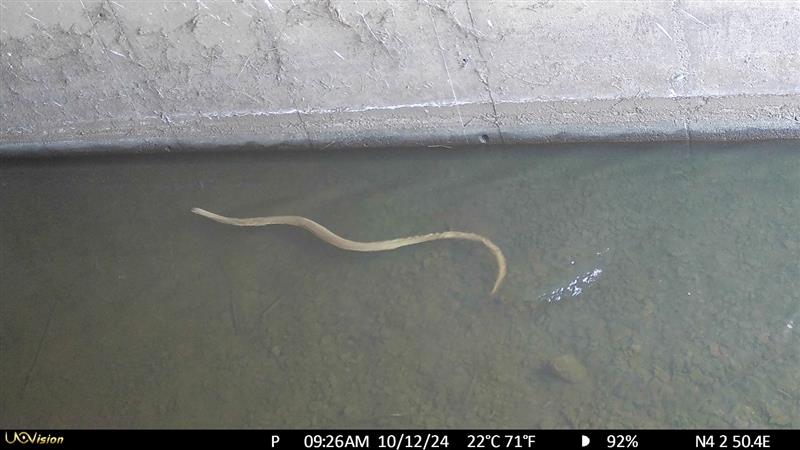
Various reptiles
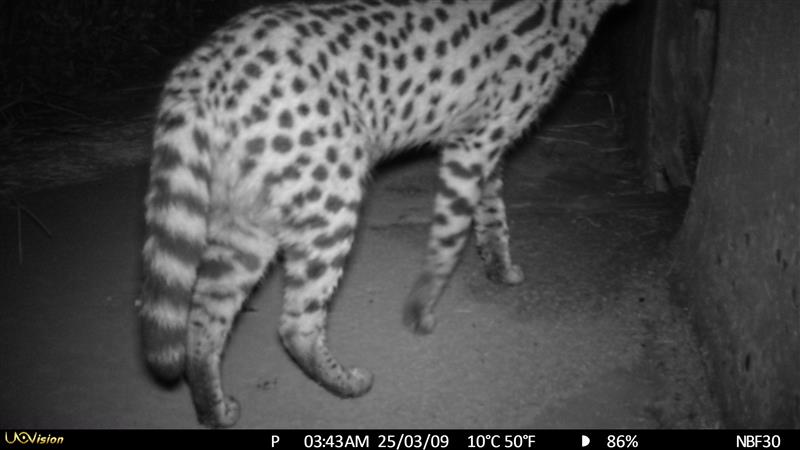
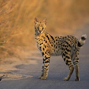
Serval
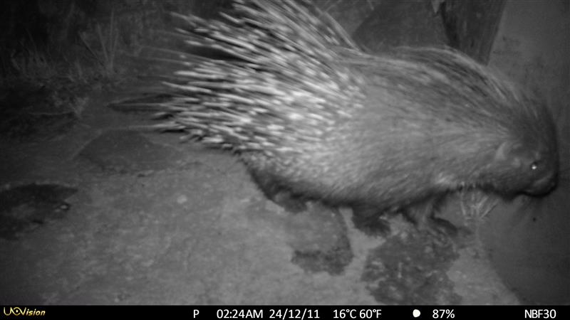
Porcupine


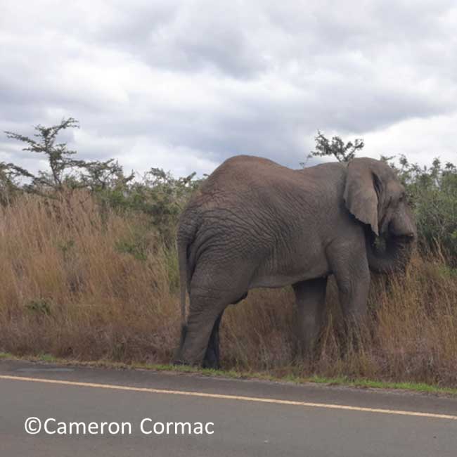
However, we do come across incidents that involve large mammals like Hippopotamus and savanna buffalo along the N4, and Greater Kudu along the Bakwena N4 and N4, as well as cows. We have also recorded incidents that involved an Elephant and a Leopard along the R40 and R71 regional roads in Hoedspruit area.

Monitoring wildlife roadkill is the first step in understanding the impacts of roadkill on threatened species. By collecting data on roadkill, we can track mortality rates and distribution patterns of the roadkill of different species (where and to what extent). Studying these elements will expand our understanding of the ecological impacts of road infrastructure and traffic on wildlife movement. These will enable us to scientifically map conservation hotspots and further develop effective mitigation strategies to reduce these threats.

As much as we talk about roadkill becoming a threat to biodiversity, it is important to understand that the landscapes fragmented by road networks that intersect animal habitats are the core drivers for wildlife roadkill incidents across the globe. Changing climatic conditions influence animal movement patterns, causing numerous species to move frequently within their landscapes in search of important ecological resources. In an environment increasingly fragmented by road infrastructure, such movements could potentially result in a deathtrap for animals due to wildlife-vehicle collisions and a lack of connectivity corridors.

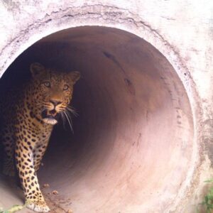
The EWT and the N3 Toll Concessionaire (N3TC), Trans African Concessionaire (TRAC) and Bakwena N1/N4 have trialed several roadkill-reduction methods for reducing the negative impacts on roads and highways on biodiversity. The first was to deploy temporary roadside fencing, directing wildlife to cross safely through underpasses such as drainage culverts. Camera traps were installed in several underpass structures that are located within hotspots to monitor whether wildlife used them, and we were excited to see that several mammals did. This includes Serval (Leptailurus serval), the most common animal killed on the N3. These results indicate that underpasses are a promising and cost-friendly alternative for wildlife crossing in a global south country like South Africa.

Preliminary results indicated increasing animal activity and the use of the underpass structures, with more mammal species appearing to use the structures that are retrofitted with mesh fencing; these include Serval, Southern Reedbuck (Redunca arundinum), Cape Clawless Otter (Aonyx capensis), Honey Badger (Mellivora capensis), and Common Warthog (Phacochoerus africanus). When more animals use the underpass structures to cross the highway, animal activity adjacent to the road is reduced; hence, reducing collisions whilst improving road safety.

Because owls and other raptors tend to use signboards and safety barriers along roads to perch on while hunting prey, such as rodents and squirrels, a second roadkill-reduction method has been tested. This has seen the EWT placing raptor perches 100 m from the road to encourage owls and other birds of prey to use these as safer alternatives and to reduce hunts on the roads. Cameras on the owl perches have recorded several birds of prey species using the installed perches for feeding or perching. This includes African Grass, Barn and Spotted Eagle Owls. Our findings showed that the more owls use the installed structures for hunting and feeding, their activity on the road is reduced.

South Africa’ s road and rail network is essential for our socio-economic development through travel and tourism, and the transport of food and goods. It is therefore critical that solutions are found to reduce the impact of transport infrastructure on people and wildlife without hindering our transport sector.
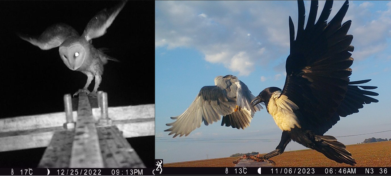
Left: Camera Trap at Raptor Perch recording a African grass owl. Right: Black winged Kite Vs Pied Crow recorded at Raptor Perch
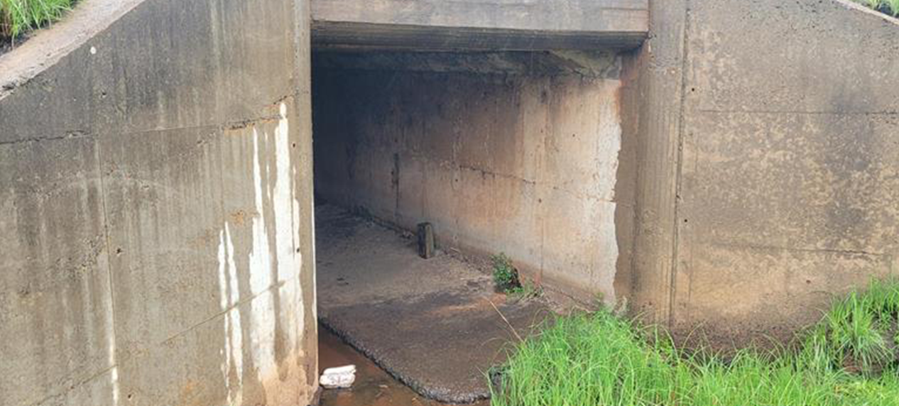
 

Modified Culverts for wildlife crossing

Wildlife and Transport Project

  • The EWT is the only African organisation with a dedicated project focusing on transport and wildlife interactions.
  • The project works across South Africa and collaborates on similar projects with colleagues worldwide.
  • Our goal is to reduce the impacts of transport infrastructure on wildlife and vice versa. We focus on improving our understanding of the threats to wildlife from transport activities and infrastructure and identifying solutions suitable to the southern African context.
  • In 2013, the EWT launched a smartphone app called “RoadWatch” – one of the first roadkill reporting apps in the world. To date, almost 30,000 data points have been reported via the app.
  • The Endangered Wildlife Trust’ s National Roadkill Database for South Africa shows that mammals are the most commonly-reported roadkill (50%), followed by birds (18%), reptiles (6%), and amphibians (1%), with 24% of species being unidentifiable.
  • Large mammals, such as carnivores and antelope, are likely to cause damage or delays to trains and vehicles. Collisions with animals can be expensive with insurance claims suggesting that approximately R82.5 million is paid yearly against vehicle collisions with wild animals.
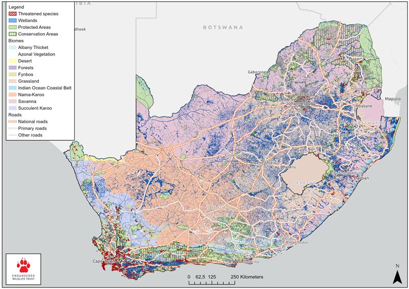
Roadkill map of South Africa

The EWT has provided support for a study that has developed a Drivers-Pressure-State-Impact-Response (DPSIR) framework of ecological connectivity in transport sustainability in South Africa. Because of the Framework, steps are being taken to help shape a sustainable transport sector that promotes robust monitoring and mapping of hotspots and the support of a consultation process to formulate policies that promote sustainable land-use planning by considering wildlife needs in green transport infrastructure planning frameworks in South Africa.
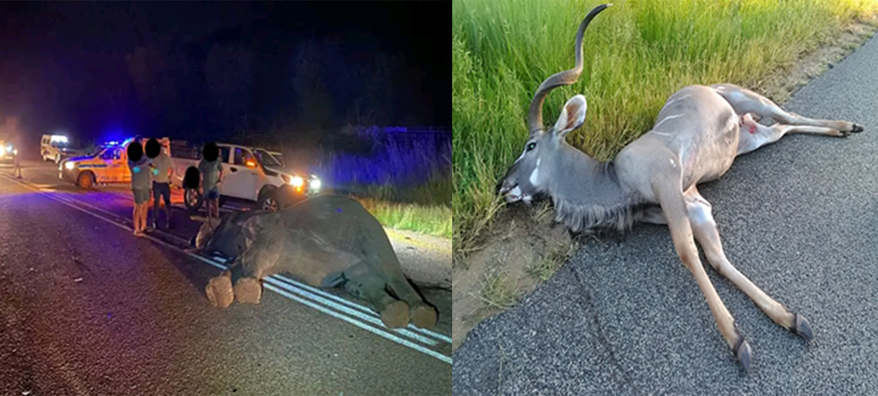
Unfortunate incidences involving large mammals
Tale from the field – The impact of roads through Zululand’ s protected areas

Tale from the field – The impact of roads through Zululand’ s protected areas

TALE FROM THE FIELD

The impact of roads through Zululand’ s protected areas: A two-year tale

Cameron Cormac, EWT’s Wildlife and Transport Programme and University of KwaZulu-Natal

The Zululand region of South Africa’ s KwaZulu-Natal Province is home to several historically important game parks. South Africa’ s conservation history has its origins in this region, with many of the country’s nature protection agencies stemming from the original parks board created to oversee South Africa’ s original game parks. Rhino protection activities also originated from this area, with global rhino protection following the region’ s example. Furthermore, these game parks are important to the Zulu people, as many house culturally significant locations. In addition to many of the reserves in Zululand being of historical and cultural importance, they act as a major source of income for this relatively poor region of South Africa.

Collecting carcass information during road surveys.

My PhD research, through the University of KwaZulu-Natal, working with the Endangered Wildlife Trust and Ezemvelo KwaZulu-Natal Wildlife, examined the effects of linear infrastructure on wildlife. I spent over 1,000 hours between February 2021 and April 2023 surveying two provincial roads that pass through Hluhluwe-iMfolozi Park (HIP) and iSimangaliso Wetland Park (ISWP). These surveys aimed to determine how animals were affected by these roads, to find out what species had the highest death tolls, and how the roads could be adapted to reduce the number of animals killed on the roads.

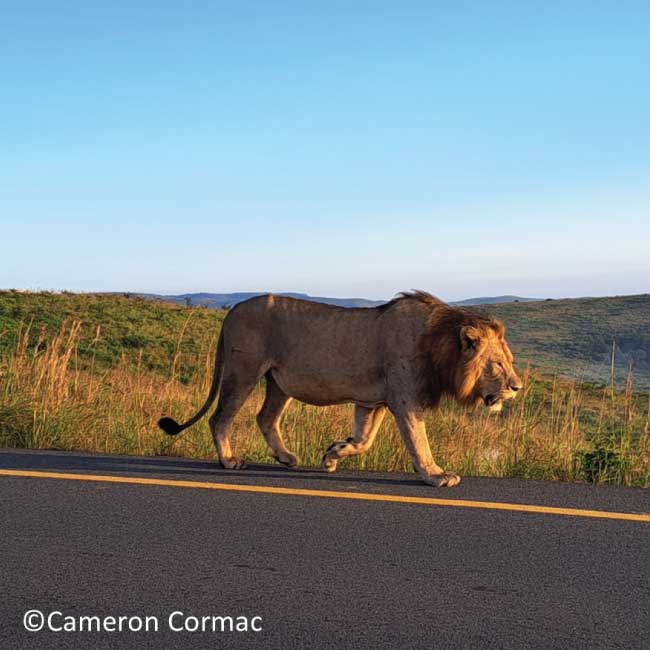
In HIP, South Africa’ s oldest protected area, the R618 passes through the younger section of the reserve, which was created to serve as a corridor to conjoin the previously separate Hluhluwe and iMfolozi Parks. Currently, the road serves as the boundary between the two sections of the park, gaining the nickname ‘Corridor Road’ . The R618 also joins the Zululand municipalities of Mtubatuba and Hlabisa and is the connection point for entry through HIP’ s Nyalazi gate. Overall, approximately 18 km of the R618 falls within the park’s boundaries and experiences a relatively high frequency of vehicle traffic. When travelling on this road, motorists are regaled by the stunning landscapes within the mostly mountainous portion of HIP and have the chance to glimpse some of South Africa’ s most iconic species, such as Lions (Panthera leo) and African Elephants (Loxodonta africana).

However, because the road is a man-made barrier across what would otherwise be a single continuous ecosystem, there are incidents of wildlife-vehicle collisions along its length. Most of these encountered during my surveys were vehicle collisions with small species (below 1 kg in body mass). However, the incidents did include animals of all sizes, from frogs as tiny as a thumbnail to fully grown bull Cape Buffalos (Syncerus caffer caffer). Over two years, I encountered many live animals on the ‘Corridor Road’ , some slightly too close for comfort. However, I also found over 500 animal road mortalities. Thanks to road maintenance activities that ended in September of 2022, I saw first-hand how effective smartly placed speed bumps, a properly maintained road surface, and drivers being forced to obey speed limits can reduce animal mortalities.

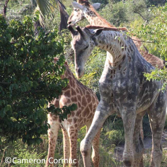
A very different tale unfolded in ISWP, one of South Africa’ s largest reserves, a UNESCO World Heritage Site, and a wetland of global significance. The KwaJozana section of ISWP that borders Phinda Private Game Reserve is split by the R22, another important provincial road that is one of the main connection points between South Africa and Mozambique. Approximately 15 km of the R22 lies between the boundary fences of ISWP, although, unlike the road in HIP, there are no speed bumps, hills, scenic vistas, or large iconic mammals to entice drivers to slow down or pay attention to the road. However, a collection of various below-surface structures, such as culverts and bridges, do allow animals to cross safely and are placed roughly every 400 m. The route also passes next to, and straight through, multiple seasonal wetlands. Despite the road being monotonous in the surrounding habitat and devoid of easily visible wildlife, I had a few exciting animal sightings, such as a rare partially leucistic giraffe (Giraffa camelopardalis). However, I was often met with animal road mortalities. Over 1,000 animal mortalities were found, with multiple mass frog death events observed during the surveys in this area.

With over 1,500 collective wildlife-vehicle collisions recorded, there is an apparent need for intervention, particularly along the ISWSP section of the R22. The next step of my project is to collate all my data and determine what type of interventions would most effectively mitigate the threat of passing vehicles to animals when they attempt to cross these roads. Although the example of the newly placed speed bumps and resurfaced road in HIP provides hope, it does not take drastic enough measures to have a noticeable effect on the number of animals that die along the route. The simplest solution would be for all drivers to be more aware of their surroundings and obey the speed limit, giving crossing animals more time to avoid passing vehicles.

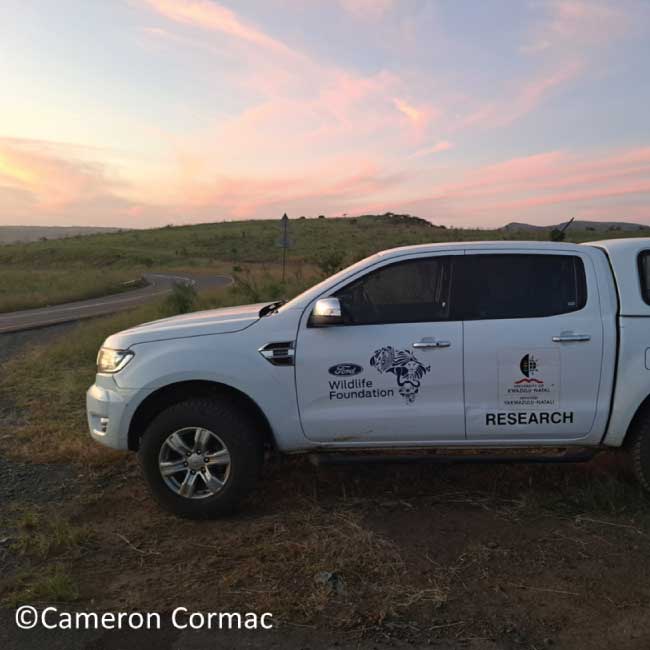
This project would not have been possible without the generous support from the Ford Wildlife Foundation and the National Research Foundation. Consider contributing to the Endangered Wildlife Trusts’ ongoing attempts to understand and reduce the threats posed by roads on South Africa’ s wildlife using the EWT Road Watch South Africa app (found in the Google Play Store and the iStore). You can help conserve our wildlife by recording wildlife-vehicle collision events and uploading photographs and locations of roadkill you find along South Africa’ s roads on the App.

Science Snippets: The impact of roads and powerlines on South Africa’ s primates

Science Snippets: The impact of roads and powerlines on South Africa’ s primates

Science Snippets: The impact of roads and powerlines on South Africa’ s primates

Erin Adams and Lizanne Roxburgh, the EWT Conservation Planning and Science Unit

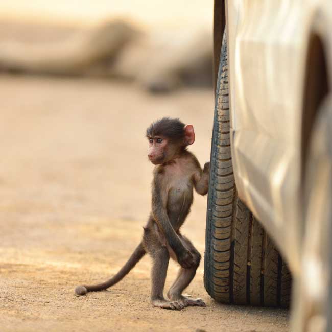
South Africa has an extensive linear infrastructure network of roads, railways and powerlines, which is essential for human connectivity. However, it is not great news for primates. Approximately 18% of the world’ s primates are directly impacted by linear infrastructure. In a recent paper* co-authored by EWT scientists, the impact of linear infrastructure on South Africa’ s primate species was studied.

Within South Africa, many primates are killed in road collisions and powerline electrocutions every year. To get an indication of the extent to which primates are affected by wildlife, data was collated from the EWT’ s database of vertebrate roadkill**, as well as from the EWT-Eskom Central Incident Register, which is a national database of wildlife incidents on electrical infrastructure, mainly electrocutions and collisions. The focal species for this study were the Vervet Monkey (Chlorocebus pygerythrus), Chacma Baboon (Papio ursinus), Thick-Tailed Bushbaby (Otolemur crassicaudatus), Southern Lesser Bushbaby (Galago moholi), and Samango Monkey (Cercopithecus albogularis).

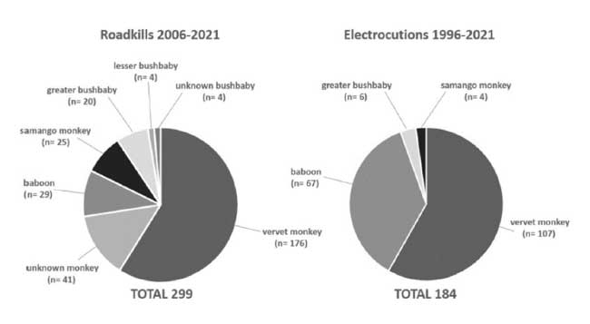
The authors found that Vervet Monkeys were most reported in both roadkill and powerline collision incidents (see the figure below). The Southern Lesser Bushbaby was least frequently reported. The data also showed that several incidents involved more than one individual. When it came to roadkill, 4% of incidents involved between two and four individuals killed in one collision, whereas in electrocution incidents, 13% of cases had between two and six individuals killed in one incident.

Graph showing the comparison of South Africa’ s primate roadkill and electrocution mortalities

Comparison of South Africa’ s primate roadkill and electrocution mortalities (from Linden et al. 2022)

The authors recommended that mitigation measures, such as canopy bridges across roads and better insulation of transformers and substations, be more widely implemented to help conserve South Africa’ s primate populations. Although South Africa leads the African continent regarding roadkill and electrocution data collection, key information, such as GPS coordinates and the age and sex of individuals, is missing. Data collection protocols can be improved to better inform mitigation measures and understand impacts on populations. Future Red List assessments should acknowledge linear infrastructure as a more significant threat to primates.

* Linden, B., Cuozzo, F. P., Sauther, M. L., & Jonker, W. C. (2022). Impact of linear infrastructure on South Africa’ s primate fauna: the need for mitigation. Folia Primatologica, 1(aop), 1-19.

** The EWT has a free road watch app available to record any roadkill sightings. This will help us identify hotspot areas as well as the species most at risk.

Saving spots and stripes

Saving spots and stripes

SAVING SPOTS AND STRIPES

Claire Patterson-Abrolat claire@ewt.org.za and Wendy Collinson-Jonker wendyc@ewt.org.za, Endangered Wildlife Trust infrastructure is a common feature wherever humans have settled. South Africa is rated as the 25th largest country in the world and ranked 18th in relation to the total road length (65,600 km paved, 689,000 km unpaved) and 74th in the total number of cars per 1,000 people. Roads are critical in providing access to primary health care, education, markets, and employment, ultimately improving livelihoods.

However, South Africa is the third most biologically diverse country in the world, and it is increasingly clear that roads and road users affect the functioning of ecosystems in which they occur. Direct collisions with wildlife have the most obvious impact, but the indirect disruption of ecological processes is equally important. Habitat loss, degradation, and population fragmentation, and disruption of the processes that maintain regional populations are just some of the ways roads can affect biodiversity.

Development is taking place rapidly, with new roads and housing developments mushrooming and trans-continental rail and road developments being expedited. In the past, such developments were planned without much thought to their impact on biodiversity, but the EWT has been working hard to improve road-user safety – that of both the occupants of vehicles and the wildlife living adjacent to or crossing our roads. We’ ve been collecting data in a variety of ways, including the use of citizen scientists (data submissions from the general public), planned surveys and, importantly, using the road patrollers that drive our highways daily to deal with any hazard they come across, including the removal of dead animals from the road.

The EWT analyses roadkill data regularly, and one of the species that has caught our attention is the Serval. This mostly solitary, nocturnal species was considered extinct, or near-extinct, in the latter half of the 20th century, largely due to the mistaken belief that it caused damage to agricultural crops and compounded by competition from other carnivores such as jackal. Reintroductions and range expansions have led this species to recover to an estimated adult population of somewhere between 4,509 and 13,654 individuals, but the population is again considered to be declining due to a loss of its wetland habitat.

Serval (Leptailurus serval)

Servals are predominantly solitary except when mating or before young would leave their mothers at around eight months old. Like Leopards, the young females form territories adjacent to that of their mother, with males having larger territories that overlap that of several females.

The N3 Toll Concession, which manages the 412 km stretch of road from Heidelburg (Gauteng) to Cedara (KwaZulu-Natal), has been extremely supportive of our efforts to mitigate roadkill along the Toll Route and is concerned about the safety of both the road users and the wildlife living alongside the road.

In addition to our usual reports to the N3 Toll Concession, the EWT has been looking into why the Serval is one of the most common species reported (Figure 2) and why their roadkill numbers show an upward trend.We plotted the location of the roadkill along the N3 and noted that although roadkills were spread along the length of the road, there was a cluster along the northern parts of the route. This area is predominantly highveld sourveld and is either farmed for cattle or game or planted with mieliesWe also looked at the proximity of water to the road. Servals are wetland specialists, which are likely to be clustered close to water bodies. Water is spread fairly evenly across the landscape, and where perennial rivers are not available, farmers have created artificial water points for livestock and/or game. The diet of Servals consists mainly of Vlei Rats, so the abundance of water along the N3 does create the ideal habitat for them.

Our work is still in its infancy, and we plan to keep investigating the drivers of roadkill for this species by investigating the following:

  • Whether Serval prefer artificial or natural water bodies;
  • The abundance of prey species;
  • Whether or not Serval use underpasses (tunnels and culverts) to cross the road; and
  • If the Serval being killed on the road are young dispersing males or breeding adults, and the impact of this on the local and broader population.

Thank you to the N3 Toll Concession for their ongoing support of our work and Ford Wildlife Foundation for keeping us on the road.

The inaugural Global Congress for Linear Infrastructure and Environment.

The inaugural Global Congress for Linear Infrastructure and Environment.

THE INAUGURAL GLOBAL CONGRESS FOR LINEAR INFRASTRUCTURE AND ENVIRONMENT

Wendy Collinson-Jonker, Endangered Wildlife Trust, wendyc@ewt.org.za The Endangered Wildlife Trust and the International Conference on Ecology and Transportation, otherwise known as ICOET, hosted the virtual Global Congress for Linear Infrastructure and Environment, on 20 and 21 September. With over 100 delegates from 24 different countries, the congress, aimed to provide a new opportunity for a global gathering that includes both the intellectual content of a scientific conference and the international reach of the United Nations and Sustainable Development Goals.

Linear infrastructure is essential for connecting society: our systems of roads, railways, pipelines, and power lines all serve to link our cities, developments and resources, and our energy and water supplies. Therefore, it is perhaps ironic that linear infrastructure does exactly the opposite for natural systems – by crisscrossing landscapes, linear infrastructure serves to fragment ecosystems, isolate populations, and reduce natural flows. Roads, railways, fences, and power lines constrain animal movements. They pose direct threats to species from collisions and indirect threats by increasing access by people to previously untapped resources.

Currently, there are five active continental conferences. The Infrastructure and Ecology Network Europe, or IENE, was established in 1996, whilst the International Conference on Ecology and Transportation, or ICOET, started in 1999, with a primary focus on the United States and North America. Both conferences presented the development of a new field of ecology. In 2009, the Australasian Network for Ecology and Transportation (ANET) commenced, followed by the Congresso Iberoamericano de Biodiversidade e Infraestrutura Viária or CIBIV in 2010 and then the newest, the African Conference for Linear Infrastructure and Ecology in 2019.

Each of these conferences has representatives from industry (e.g., planning, engineering, construction), representatives from transport, regulatory, planning, and environmental agencies at all levels of government, research institutions, non-government organisations, environmental consultants, and community groups (e.g., wildlife carers, environmental groups). While these conferences promote international participation, they are inherently focused on the work and issues important to their host continent, but they have joined forces for the Global Congress for Linear Infrastructure and Environment. GCLIE is intended to complement the existing continental conferences on transportation ecology by providing a platform that focuses on broader, higher-level, global issues and policies that can influence national and international knowledge sharing and bring about positive change.  The Global Congress will facilitate truly global opportunities for conversation and debate issues that create bridges between and push the boundaries outside of our respective continental conferences, aiming to improve our understanding of world issues and influence action at this scale.


Building on the achievements of the continental conferences, the event also aims to develop tools (e.g., scientific briefs on particular topics) for influencing global decision-makers to aim for more sustainable new and existing linear infrastructure. The event is organised back-to-back with ICOET held virtually from 22-30 September 2021.

After nearly a year and a half of the global pandemic, we’ re all extremely familiar with online engagement, and the online format has certainly enabled the participation of people from afar and will allow for constructive interaction among participants. By bringing together a diverse range of participants from across the world, GCLIE is fostering a community of practice that will collectively answer some of the most challenging questions of our time.

“I attended the GCLIE as a precursor to the 2021 ICOET conference.  This congress was a truly comprehensive global overview of the factors fragmenting habitat, disturbing ecological functions, and impeding the necessary and natural movement of wildlife at multiple scales.  Throughout the congress the conceptual framework of thinking globally and acting locally manifest in the case studies and policy level presentations and discussions.  The GCLIE was an opportunity to identify commonalities, both great and small, that transcend geopolitical boundaries and align practitioners, academics, and policy-makers for success. The virtual format facilitated global participation and representation.  Very well done.  I look forward to the next GCLIE.”   

– Chris Slesar | Environmental Resource Coordinator, Vermont Agency of Transportation, USA

“GCLIE was the first opportunity to discuss research and policy related to mitigating the impacts of linear infrastructure at a global level – involving a high diversity of researchers and practitioners with experience from all around the world. It felt reassuring to notice that different continents face similar challenges and to discuss together how we can all collaborate to overcome them.”

Dr. Fernanda Z. Teixeira, Postdoctoral researcher, Ecology Graduate Program, Federal University of Rio Grande do Sul (UFRGS)

“I had the pleasure this week to participate in the coming together of a global forum on transportation and the environment. The world is being transformed at an unprecedented speed through the construction of roads, railways, pipelines and other transportation infrastructure, and GCLIE must play a pivotal role in ensuring the infrastructure that is planned and built today has a positive impact on society and the natural environment. The need for GCLIE has never been more critical – and I am excited to see how GCLIE develops in the years ahead.”

Dr Rodney van der Ree, National Technical Executive – Ecology, WSP Australia Pty Limited

GCLIE 2021 not only provided a necessary bridge between existing continental communities of practice but begun the critical work of leveraging national and continental solutions to generate a global movement for ecologically sustainable linear infrastructure. Sarah Chiles, Landscape Infrastructure Advisor – Kenya, Ewaso Lions & Grevy’ s Zebra Trust

LATEST STORIES